


DENVER – A few strong storms will continue late night for the eastern plains near Hugo toward Cheyenne Wells. Flooding may be an issue with these slow moving storms.

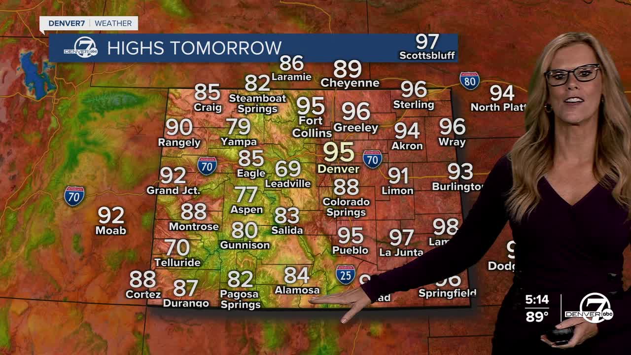
For Monday, afternoon highs will be in the mid-90s with mostly cloudy skies for the Front Range. Better chances for rain will show up for NE Colorado into the afternoon, and again late night.
By Tuesday and especially Wednesday, we’re looking at more widespread thunderstorm chances as moisture levels climb to well above normal. This bump in atmospheric moisture means that storms could drop heavier rain in short bursts, raising the potential for localized flooding, particularly in mountain areas and spots that have already seen recent rain.

Temperatures will take a brief dip midweek, especially Wednesday and Thursday, as a weak front moves through. This will bring some slight cooling to the plains and offer a temporary break from the recent stretch of 90-degree afternoons. It won’t be a dramatic cooldown, but highs should come down just enough to be noticeable, particularly with the added cloud cover and scattered showers.
Looking ahead to next weekend, the heat looks to return. Starting Friday, temperatures will begin climbing again, and by Saturday and Sunday, many lower elevation spots could be flirting with triple digits. With the return of the heat and somewhat drier conditions, thunderstorm chances may decrease again, making for a hot, mostly dry weekend across the region- with record heat a possiblity.
DENVER WEATHER LINKS: Hourly forecast | Radars | Traffic | Weather Page | 24/7 Weather Stream
Click here to watch the Denver7 live weather stream.
