

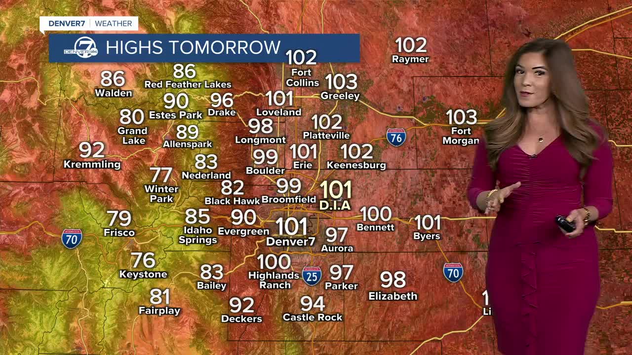


DENVER — Get ready for another scorching hot weekend across Colorado! We're looking ahead to a few sizzling, sunny and smoky days along the Front Range. A ridge of high pressure is building into Colorado and that will lead to some pretty serious heat.
- Watch the full forecast in the video player below.
After a 95-degree day in Denver, it'll be a warm and smoky evening. Overnight lows will only dip into the upper 60s under mostly clear but hazy skies.
Buckle up! Temperatures go even warmer on Saturday and Sunday! Afternoon highs will climb into the upper 90s to around 105 degrees across the plains, making it the hottest stretch we've seen in a while.
A Heat Advisory will go into effect at 11 a.m. Saturday until 8 p.m. Sunday across the Denver metro area. The city could see its sixth and seventh triple-digit days of the year this weekend. Typically, Denver only sees one a year!
Along with the unprecedented summer heat, thick smoke from wildfires burning in the Pacific Northwest will continue to blanket much of our state. Air Quality Health Advisories remain in effect across much of Colorado through the weekend. If you have respiratory issues or asthma, limit your time outdoors.
With the hot, dry weather conditions, fire danger concerns will stay high across Colorado this weekend. If you're spending time outdoors, be extra careful to avoid anything that could start a fire.
It looks like another scorcher on Monday and Tuesday with upper 90s along the Interstate 25 corridor. As we tap back into some monsoon moisture, temperatures will start to ease back a bit as clouds and storm chances increase mid-week. Relief is in sight, we'll just have to wait for it to get here.
DENVER WEATHER LINKS: Hourly forecast | Radars | Traffic | Weather Page | 24/7 Weather Stream
Click here to watch the Denver7 live weather stream.
