


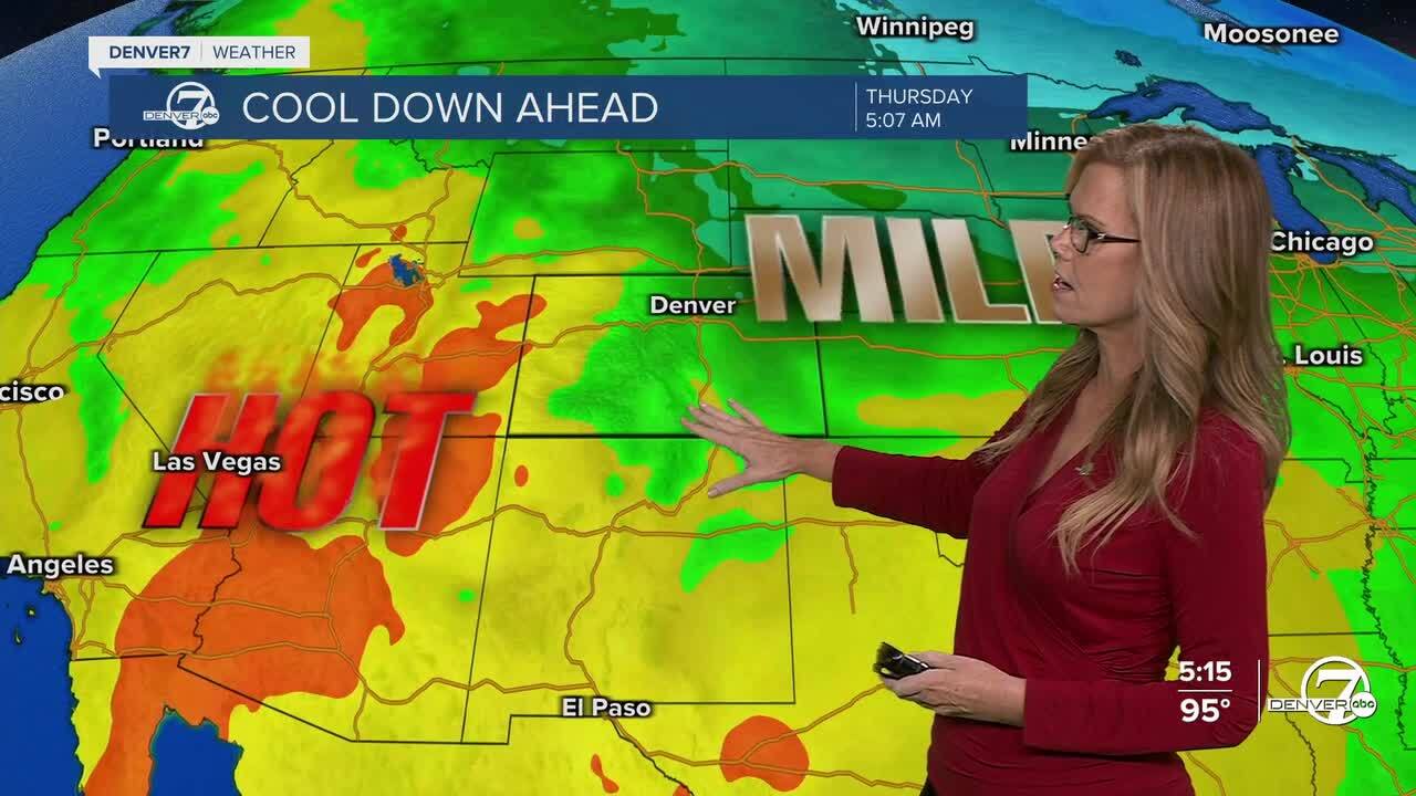
DENVER-Expect hot and dry conditions to continue tonight through Monday across the region, with very little relief from the heat. Overnight lows won’t cool down too much, especially in urban areas, and fire danger will remain elevated in the high country due to the dry air and gusty winds. If you're headed into the mountains, be extra cautious with anything that could spark a fire.

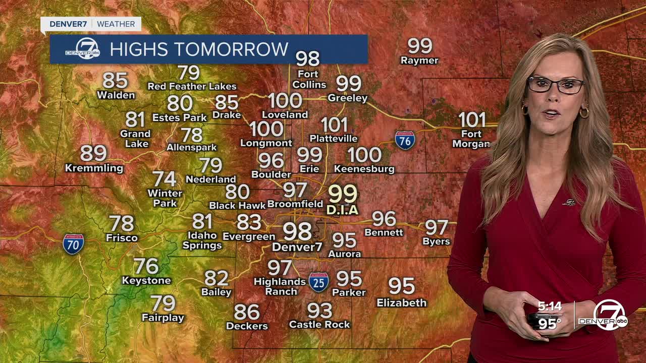
Monday looks to be even hotter than today. High temperatures across the lower elevations, including the Denver metro area, could push past 100°F in some spots. Although a bit more cloud cover may develop in the afternoon, don’t count on it helping much with the heat. It's going to be a scorcher either way, and it's still looking bone dry. Fire danger stays elevated, especially in areas with dry grass or beetle-killed timber.
Things start to shift on Tuesday. We’ll still be warm, but not quite as extreme, and we’ll start to see moisture return to the area. That means afternoon and evening thunderstorms could pop back up, especially on the plains and foothills. These storms might bring brief downpours, gusty winds, and lightning, so it’s a good idea to keep an eye on the sky if you have outdoor plans.
By Wednesday and Thursday, we’re looking at a much wetter and stormier pattern setting up. Dew points will rise, making it feel a bit more humid, and we could see more widespread and potentially heavy rainfall across much of the region. There's still some uncertainty about how long this wetter period will last, but there’s growing confidence that at least a couple of active days are on the way. Unfortunately, much of this rain will likely stay east of the Continental Divide.
Looking ahead to Friday and the weekend, things should start to dry out and warm back up. Highs will creep back toward 90°, but some scattered showers and storms will still be possible each afternoon. While it won’t be as stormy as midweek, we’re not totally in the clear, so expect a mix of sunshine, heat, and a few chances for pop-up storms heading into next weekend.
I
DENVER WEATHER LINKS: Hourly forecast | Radars | Traffic | Weather Page | 24/7 Weather Stream
Click here to watch the Denver7 live weather stream.
