


DENVER — The dog days of summer are officially here, as temperatures soar into near record-setting territory this entire week.
While the Denver metro area remains dry, a few severe storms are rumbling across the eastern plains. We could see some larger hail and damaging winds with the few storms that pop up near the Colorado/Kansas border. A Severe Thunderstorm Watch is in effect for much of the eastern side of the state until 10pm.
Look for partly cloudy skies overnight in the city along with lows in the upper 50s to lower 60s. The hazy sunshine is back early Tuesday morning, with another plume of dense smoke coming from wildfires burning out west.
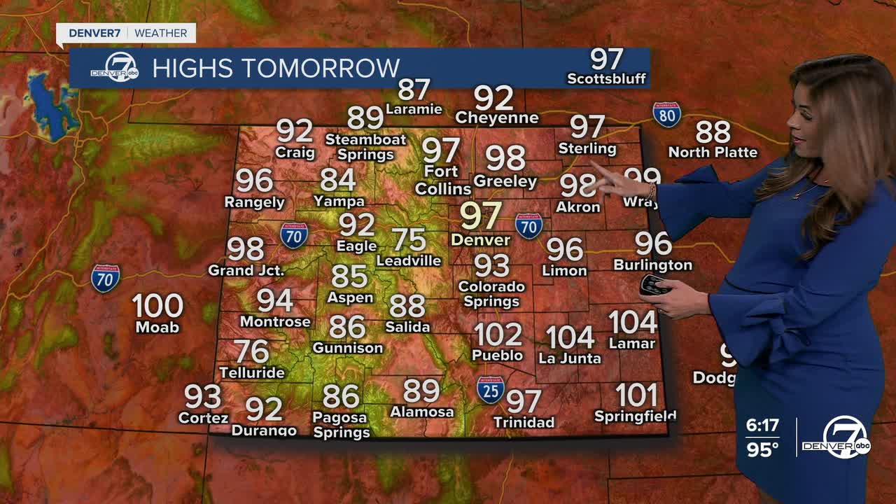
A ridge of high pressure will remain in place through the end of the week. We'll see upper 90s to even some the low 100s from Tuesday through Friday under partly sunny skies.
The record high in Denver Thursday is 99-degrees, last set in 1980. The current forecast high is 100-degrees, so we could break the record!
By late in the week, moisture slowly starts to return as a weather system approaches from the northwest. A backdoor cold front will scoot across Eastern Colorado late Friday, dropping daytime highs into the 80s for the weekend. We'll be tracking a better chance of some much-needed showers and storms Saturday and Sunday afternoons.
DENVER WEATHER LINKS: Hourly forecast | Radars | Traffic | Weather Page | 24/7 Weather Stream
Click here to watch the Denver7 live weather stream.
