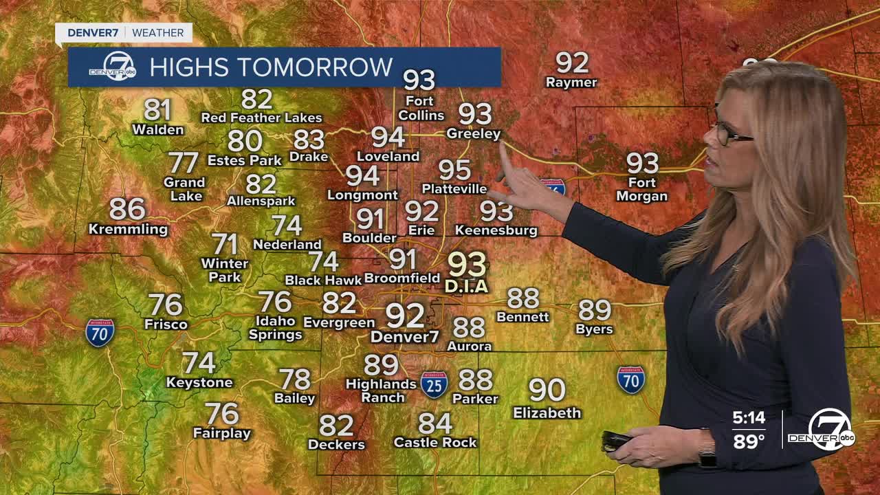


Afternoon highs made it into the low 90s for the Front Range on Sunday afternoon. The hot, dry air stays with us all next week.
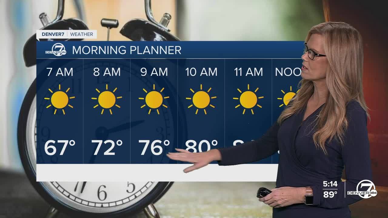
Looking ahead to Monday, we start a stretch of warmer and drier weather. While a few isolated afternoon storms are still possible in the mountains, the overall moisture in the atmosphere is dropping quickly. Most of the plains should stay dry, and high temperatures will continue to climb into the low to mid 90s. Summer is still in full swing, so make sure to stay hydrated and keep an eye out for the sun & heat.

Midweek is shaping up to be the hottest part of the week. Wednesday and Thursday look dry and toasty, with highs reaching the mid to upper 90s across the plains and into the 80s in the mountain valleys. With dry air and lots of sunshine under a strong upper-level ridge, these will be classic August days—hot, dry, and mostly storm-free.
By next weekend, we might get a break from the heat. Forecast models are hinting at a cool-down as a system to our north pushes a cold front down into Colorado. This could bring some cooler air and a better shot at showers and storms again, though it’s still a bit early to say for sure..
DENVER WEATHER LINKS: Hourly forecast | Radars | Traffic | Weather Page | 24/7 Weather Stream
Click here to watch the Denver7 live weather stream.
