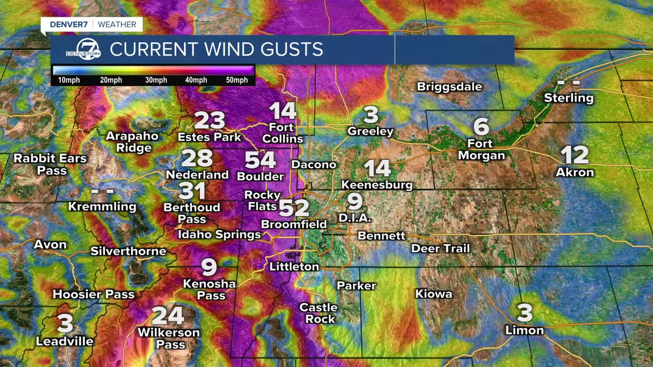


DENVER — The unseasonably warm weather continues for another two days. We're seeing temperatures in the 30s and 40s Tuesday morning and the winds are already starting to pick up on the west side of town.

A Red Flag Warning goes into effect at 8 a.m. Tuesday and includes portions of Boulder, Jefferson, Broomfield and Douglas counties. We'll see wind gusts around 55 mph, with an occasional gust closer to 70 mph.
It will be mainly breezy closer to and east of Interstate 25, with winds between 15 to 30 mph. Temperatures will quickly climb into the 50s by lunch and highs near 60 degrees by 2 p.m. It will be a mild day for all the kids going back to school!
The winds will calm down Tuesday night and it won't be quite as gusty on Wednesday. Temperatures will also be a touch cooler, with highs in the mid 50s and that's still about 10 to 12 degrees above normal.
A stronger storm will roll into Colorado on Thursday. We'll see the chance for a few light snow showers on the plains early Thursday, with heavier snow by Thursday night. Friday will also be quite a big colder. With highs in the 30s, it will be about 30 degrees colder than how we started the week.
Skies will gradually clear on Friday afternoon and temperatures will gradually climb into the weekend.
DENVER WEATHER LINKS: Hourly forecast | Radars | Traffic | Weather Page | 24/7 Weather Stream
Click here to watch the Denver7 live weather stream.
