


DENVER — It's a quiet start to the day across the Eastern Plains, but we're already starting to see more snow in the mountains and it's going to get even heavier overnight.

We'll see a mix of sun and clouds for the Friday morning drive. Temperatures will climb into the upper 30s to low 40s on the plains, with more 20s in the mountains. Heaviest snowfall Friday will be over the northern mountains, with around 4 to 8 inches of snow possible near Steamboat and over Rabbit Ears Pass.
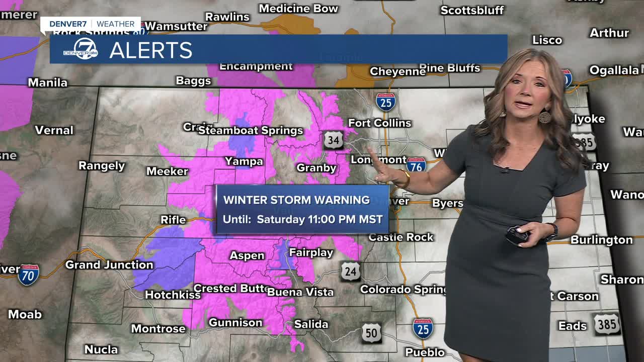
The snow will spread south and turn heavier Friday night. A winter storm warning is in effect for most of the high country and goes into effect tonight for around 1 to 2 feet of snow by early Sunday.
Combined with strong winds gusting up to 55 mph, blowing snow is likely and could cause major travel issues. Road closures are possible, and travel through or into the mountains could be difficult or impossible at times.
The metro and plains, however, are expected to see little to no snow accumulation. Saturday will stay windy, with slight chances for rain or snow showers throughout the day. We'll see highs in the mid to upper 40s on Saturday and Sunday.
DENVER WEATHER LINKS: Hourly forecast | Radars | Traffic | Weather Page | 24/7 Weather Stream
Click here to watch the Denver7 live weather stream.
