


DENVER — Winds will calm down tonight which will lower the fire danger compared to earlier today, with calmer conditions expected overnight. Expect partly cloudy skies and dry conditions for the eastern plains.
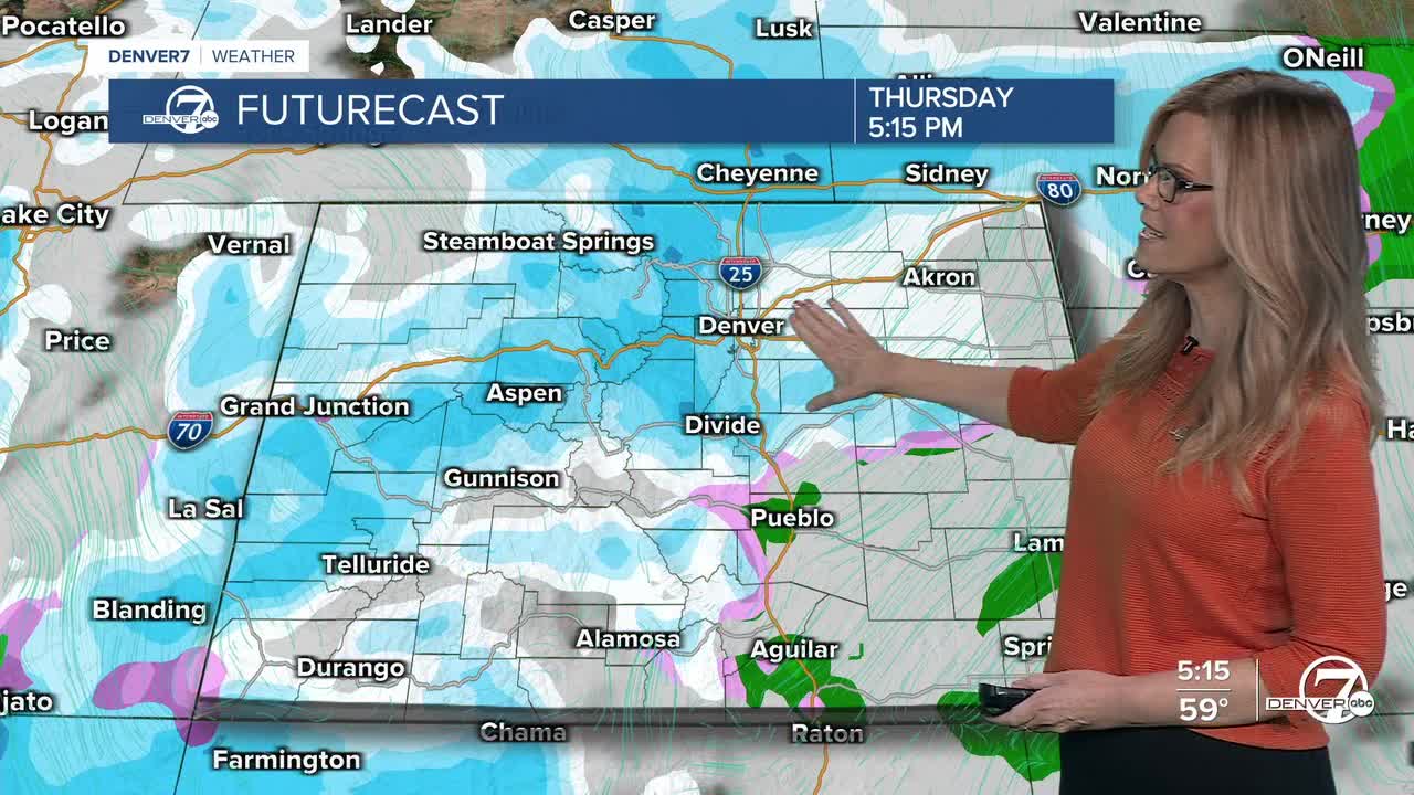
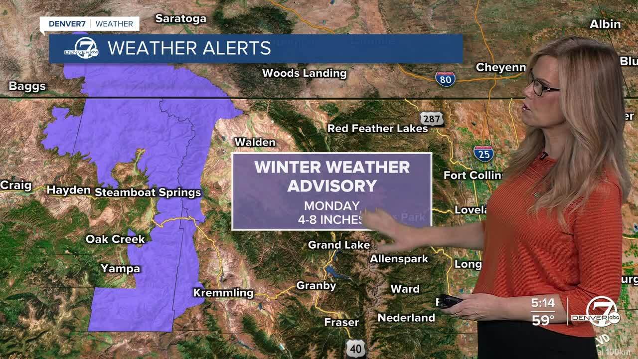
On Monday, another weather system will move into the mountains. Snow will begin in the northern mountains during the morning and continue into Monday night. The heaviest snowfall is expected in the Park Range, where several inches will likely accumulate, while other mountain areas see lighter amounts. Snow will gradually taper off late Monday night, with only a few lingering snow showers by Tuesday. A Winter Weather Advisory is in effect in NW Colorado around Steamboat for Monday, for 4-8" of snow.
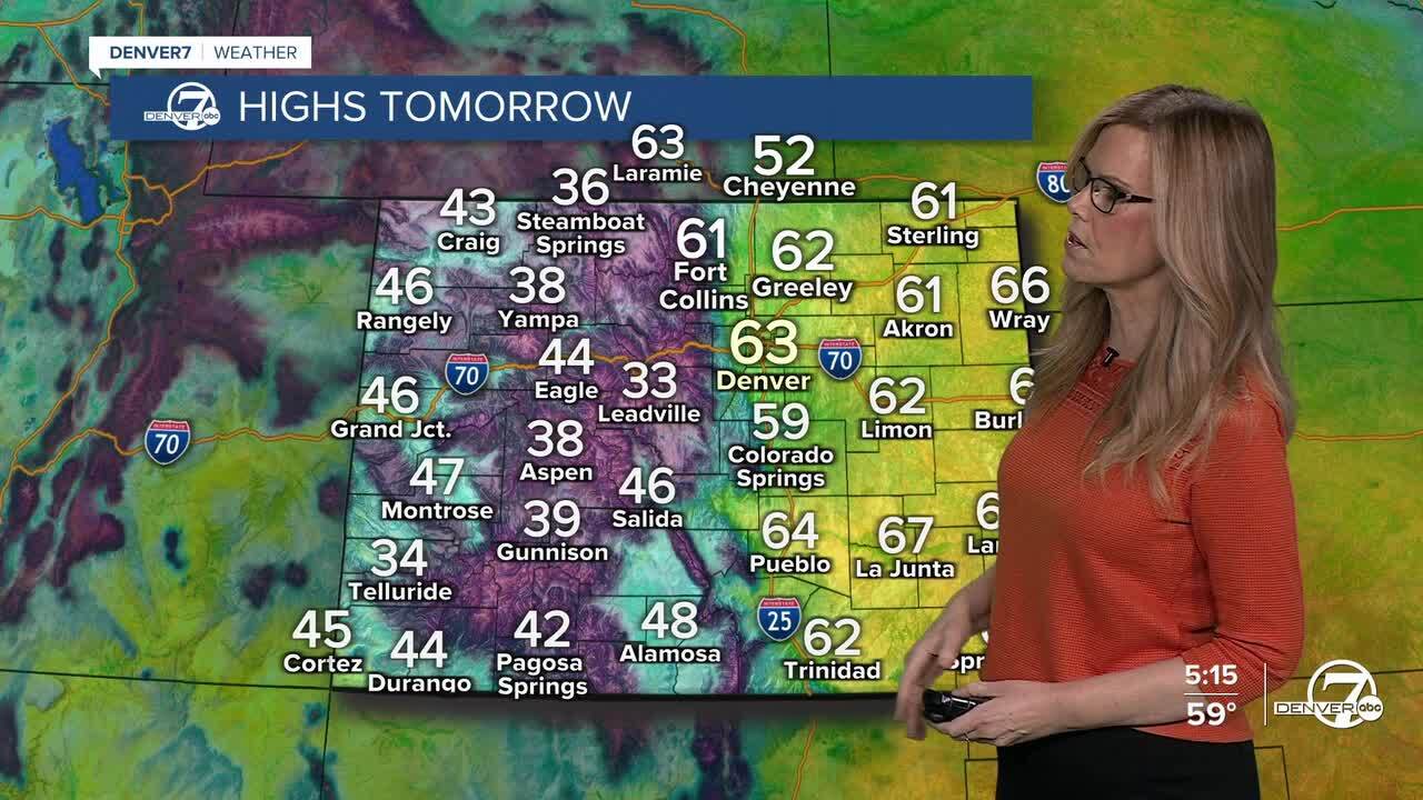
Lower elevations, including the plains and the I-25 corridor, will stay dry through midweek. However, it will become breezy again Monday afternoon and continue at times through Tuesday. Even with the breeze, temperatures will remain mild for this time of year, reaching the upper 50s to lower 60s on Monday and cooling slightly but still above normal on Tuesday.
Fire weather conditions will become elevated again Monday and Tuesday due to the dry air and gusty winds. While conditions may approach concerning levels, temperatures will cool just enough to keep the fire danger below critical levels. Wednesday looks quieter overall, with lighter winds, mild temperatures, and only a small chance of light mountain snow.
Looking ahead to Thursday and Friday, colder and more unsettled weather is expected to return. There is still some uncertainty, but temperatures will be cold enough for snow if precipitation develops, and at least light snowfall is possible across parts of the region. This pattern shift will bring a more wintry feel to end the week.
DENVER WEATHER LINKS: Hourly forecast | Radars | Traffic | Weather Page | 24/7 Weather Stream
Click here to watch the Denver7 live weather stream.