


DENVER — Tonight will be mild and quiet across the Denver metro and northeast Colorado, with partly cloudy skies and temperatures staying well above normal for late December.
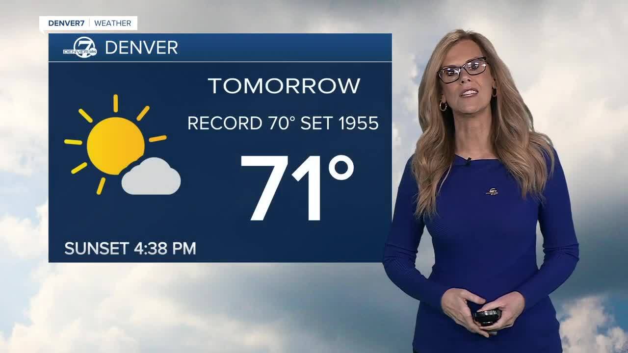
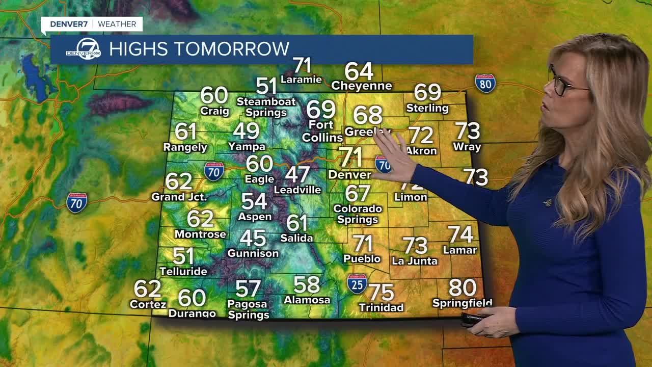
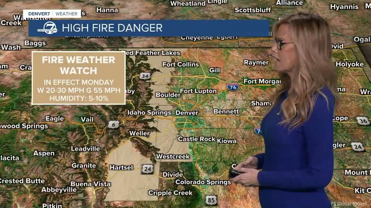
On Monday, very warm weather will be the main story. Downsloping winds and strengthening southwest winds aloft will help push temperatures into the low to mid 70s on the plains, with Denver likely breaking its daily record high of 70 degrees. Winds may become gusty near the foothills during the afternoon, while lower elevations stay breezy at times, and the warm, dry air may lead to elevated fire weather concerns. A Fire Weather Watch is in effect for the foothills on Monday with elevated fire danger.
Monday night through Wednesday will stay dry and unusually warm under persistent southwest flow aloft. Highs will generally range from the mid 60s to lower 70s across northeast Colorado, with some passing high clouds at times. Winds should be relatively light, especially Tuesday and Wednesday, keeping conditions calm and pleasant for this time of year.
On Thursday, southwest flow strengthens as a weather system approaches the West Coast. Temperatures will remain well above average on the plains, but winds may increase in the mountains and foothills. Increasing Pacific moisture will bring snow to the mountains, favoring the western ranges, while lower elevations remain dry. It's looking like snow might be falling for some mountain towns on Christmas Day.
By Friday and into the weekend, temperatures will trend slightly cooler but still stay above normal, with highs mainly in the upper 50s to mid 60s. Snow chances continue in the mountains, especially across the southwest ranges, while the plains see little to no precipitation. A weak cold front later in the weekend will bring near-normal temperatures, though forecast confidence decreases on the exact timing and impacts.
DENVER WEATHER LINKS: Hourly forecast | Radars | Traffic | Weather Page | 24/7 Weather Stream
Click here to watch the Denver7 live weather stream.
