


DENVER — Skies will clear out tonight, but the calm weather comes with a catch, fog is likely to form after midnight. Some of that fog could be dense, especially in the South Platte valley north of Denver, and in a few high mountain valleys. Most of the Denver metro should stay fog-free thanks to light downsloping winds.

Once the morning fog lifts Saturday, sunshine returns and the day will warm up nicely. Temperatures should climb a few degrees above normal, and winds will stay light with a ridge of high pressure overhead. Overall, Saturday looks calm, bright, and pleasant- with highs near 60 degrees.
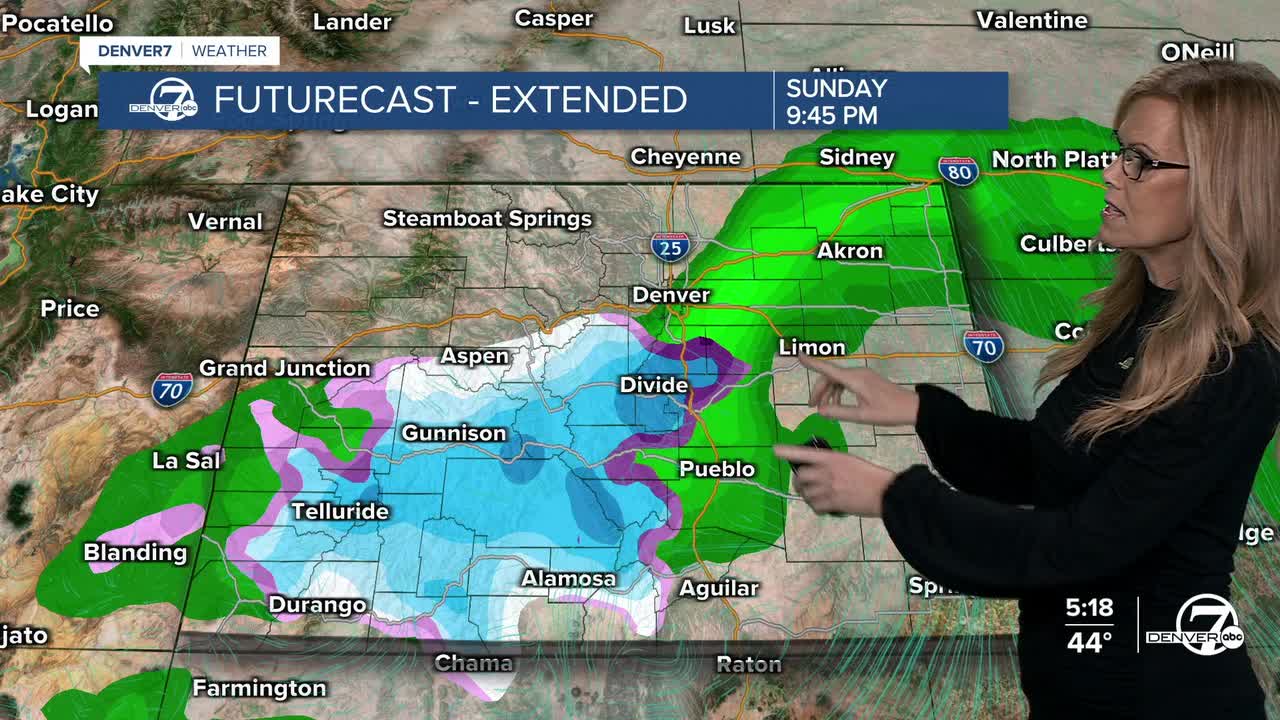
On Sunday, another round of light precipitation is possible as an upper-level low moves across Colorado. The best chances for rain or snow will be south and east of Denver, while areas northwest of the metro may see little. Snow levels should hover around 7,000 feet, meaning light snow in the mountains and light rain elsewhere. Most of what falls should stay on the lighter side. This will be a very similar storm to the one we saw on Thursday.
Monday and Tuesday will bring a noticeable change as a fast-moving system sweeps in from the Pacific Northwest. Expect increasing winds—possibly strong at times—and colder temperatures. Snow chances pick up in the northern mountains Monday night, but conditions should gradually improve by Tuesday as the system moves out.
Heading toward Thanksgiving, the weather looks to settle down. Winds will ease, temperatures will moderate, It looks like we have a chance for rain on Wednesday night and partly cloudy skies for Thanksgiving Day. Travel conditions through midweek appear better than earlier expected, though another round of MUCH colder, possibly snowy weather may arrive later in the holiday weekend.
It looks like highs will drop into the 20s for highs by the weekend after Thanksgiving- and snow will show up- so travels home from Thanksgiving may be affected by extreme cold and snow.
DENVER WEATHER LINKS: Hourly forecast | Radars | Traffic | Weather Page | 24/7 Weather Stream
Click here to watch the Denver7 live weather stream.
