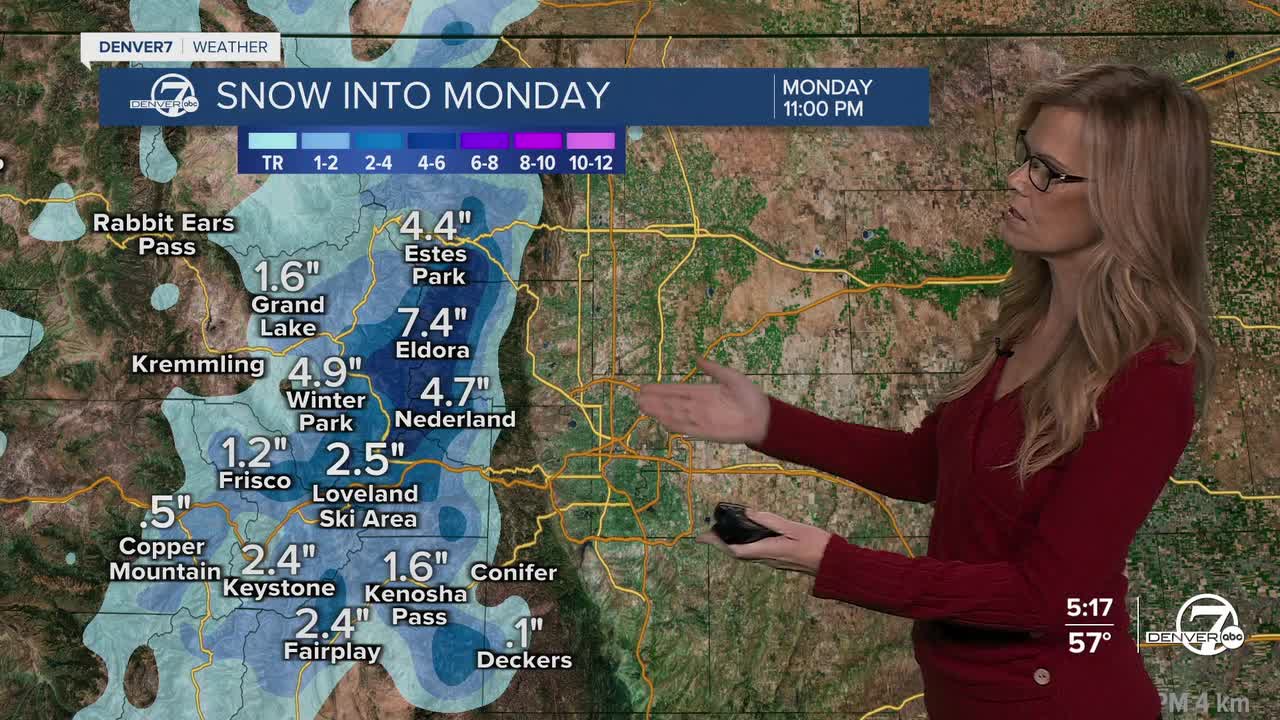


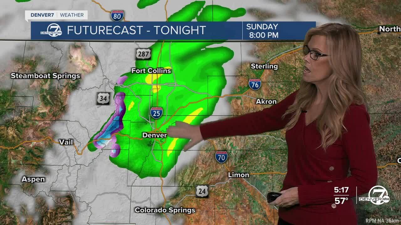
DENVER — It’s shaping up to be a chilly and damp night across the Front Range, especially in the mountains and higher foothills where snow will be falling. If you’re heading up to places like Cameron Pass or Trail Ridge Road, be prepared for winter driving conditions, several inches of snow could fall overnight, especially in areas like the Mummy Range and western Boulder County. Snow levels will generally lower to around 8,000 feet in the northern foothills, but will likely stay closer to 9,000 feet south of I-70.
Lower elevations like the I-25 corridor won’t see snow, but expect scattered rain showers through tonight, and a steady light drizzle is likely out on the eastern plains.
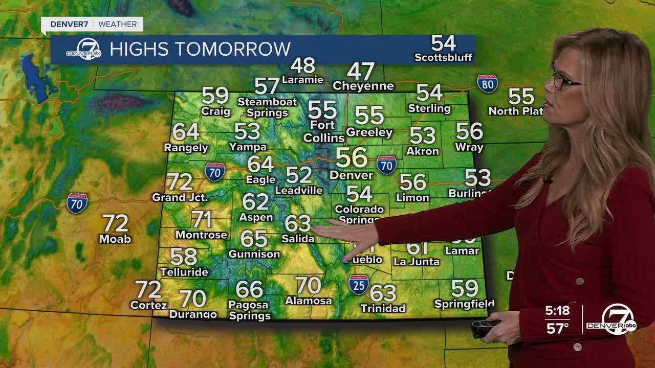
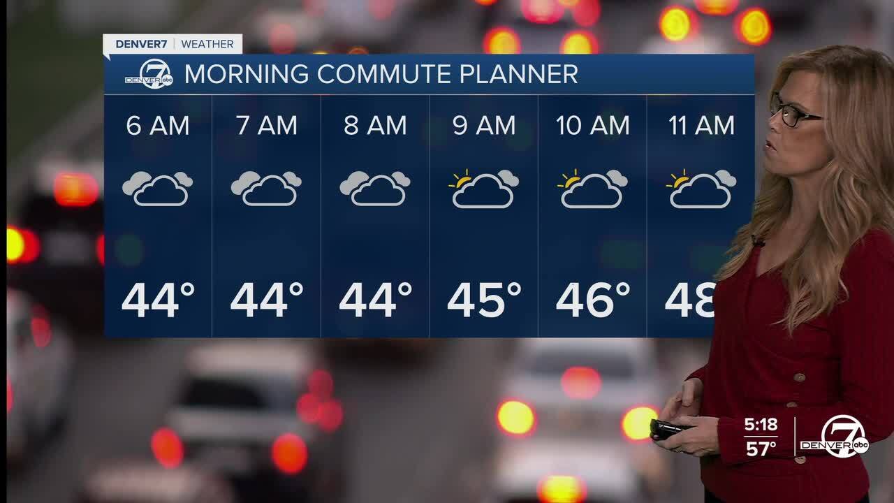
As we head into Monday, that moisture will linger, but the intensity of the precipitation should taper off a bit. We’ll still be stuck under a cool, cloudy sky though, with daytime highs barely making it into the low to mid 50s along the urban corridor. Some spots may even stay in the 40s all day. The clouds and weak upslope flow will keep things damp, especially early in the day, and the chill in the air will be hard to miss.
By Monday afternoon, there’s a chance we could see showers fire up again, especially near the foothills and potentially stretching across the Denver metro. The overall setup isn’t as strong as Sunday night’s, but models do hint at some weak bands of precipitation pushing eastward during the evening. While nothing too heavy is expected, don’t be surprised if you get caught in a brief shower.
Clouds will likely hang on through Monday night, which should help keep temperatures from dropping too low overnight. That lingering cloud cover means we’ll probably avoid frost concerns on the plains, but it'll still feel quite cool. As we move into Tuesday, we’ll finally start to dry out and warm up a bit, though Tuesday will still be on the cool side of normal for early October.
Looking ahead to the second half of the week, a much warmer pattern will settle in. By Wednesday, we’ll see sunshine and noticeably warmer temperatures returning—highs should be several degrees above average and continue that way into the weekend. It’ll be a nice stretch of fall weather with dry conditions for most areas, though there’s a small chance of mountain showers by Friday or Saturday. Enjoy the warm-up while it lasts!
DENVER WEATHER LINKS: Hourly forecast | Radars | Traffic | Weather Page | 24/7 Weather Stream
Click here to watch the Denver7 live weather stream.
