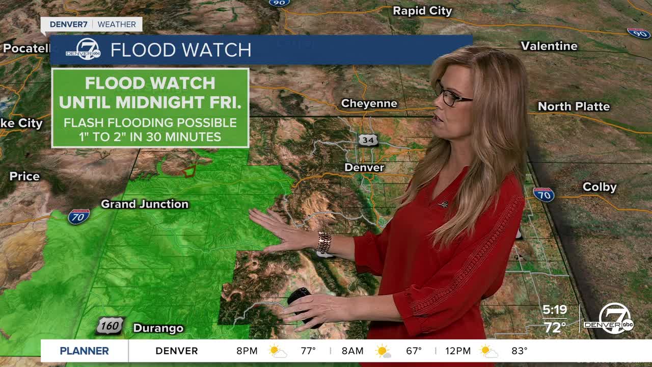


A Flood Watch is in effect until midnight Friday for the potential of flash flooding. Some areas in western Colorado could see 1-2 inches of rain from slow-moving thunderstorms.
For the rest of tonight, things will stay a bit unsettled with some scattered showers and a few thunderstorms, mostly over the mountains and nearby plains. The rain will be heavier in spots around the higher elevations, especially near the Indian Peaks and Larimer County, where a couple of inches could fall. If you see any storms, watch out for some gusty winds that could blow around 45 to 55 mph. Most of the stronger weather will stay to the west, but some showers might sneak east later in the night.
Saturday looks like the day with the best chance for more rain and thunderstorms. Moisture will keep flowing in from both the Pacific Ocean and the Gulf, helping to fuel storms especially in the afternoon. Where the sun comes out, storms could get a little stronger, with wind gusts up to 50 mph and maybe some hail about the size of quarters. These storms will move pretty fast, so be ready for quick changes in the weather.

On Sunday, the rain will start to calm down as the storm system moves out. You might still see some showers in the morning and early afternoon, but things should clear up by evening. It’ll stay cooler than usual all weekend, with highs mostly in the 70s and even some light snow possible on the tallest mountain peaks.

Looking ahead to Monday and Tuesday, the weather will be nicer and warmer for a couple of days. A bit of sunshine will come back, and temperatures will climb into the upper 70s and low 80s. It should be dry and pretty comfortable for most of the area during this time.
Later in the week, another storm will roll in from the Pacific Northwest, bringing cooler and wetter weather again. The details aren’t quite clear yet, but it’s something to keep an eye on for midweek.
DENVER WEATHER LINKS: Hourly forecast | Radars | Traffic | Weather Page | 24/7 Weather Stream
Click here to watch the Denver7 live weather stream.
