


DENVER — Tonight, things will begin to calm down a bit after a pretty intense day. The light snow showers in the mountains will gradually taper off and come to an end, while winds ease compared to earlier, but it’ll still stay breezy overnight, especially in the Front Range mountains and out across the eastern plains. It won’t be as harsh as today, but you’ll still notice the wind if you’re out late.

Earlier this evening, fire weather conditions remain a big concern across the plains. Strong, gusty winds combined with very dry air have created conditions where fires could start and spread easily, so that risk sticks around through the early evening hours before improving later tonight as winds slowly settle.
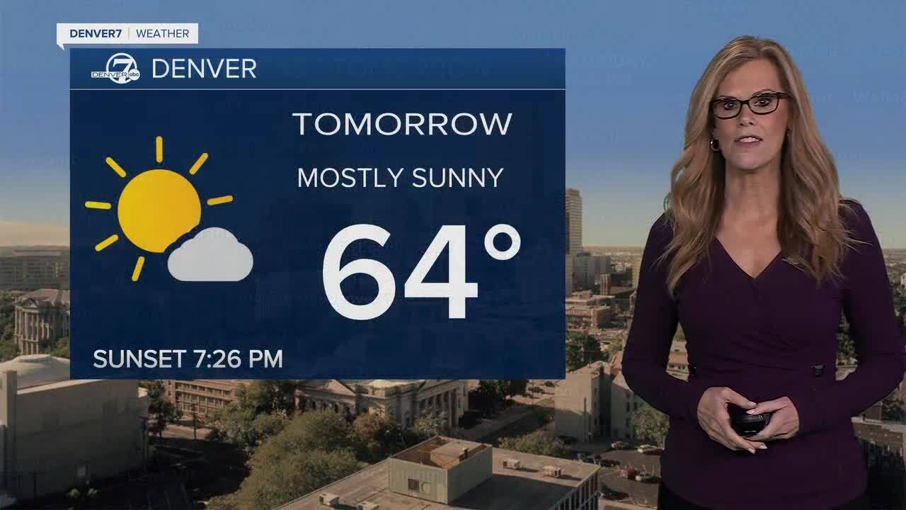
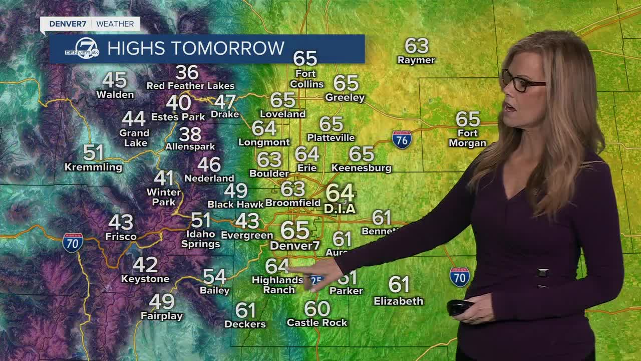
Heading into the weekend, the overall trend is quieter and warmer. Saturday and Sunday both look dry with temperatures climbing into the 60s across the plains. It won’t be completely calm, though, Saturday could still be a bit breezy, especially farther east, and that may bring another round of elevated fire danger.
On Monday, there’s a weak system passing by that could bring a few light snow showers back to the mountains, while the plains stay mostly dry.
Looking ahead to the middle of next week, warmer weather returns with highs pushing into the 70s across the plains. It’ll stay dry for the most part, with breezy conditions at times and continued concerns about fire weather, especially in places like South Park and parts of the plains. There are some early signs of a better chance for precipitation toward the end of next week, but for now, it’s mostly a warm and dry stretch.
DENVER WEATHER LINKS: Hourly forecast | Radars | Traffic | Weather Page | 24/7 Weather Stream
Click here to watch the Denver7 live weather stream.
