


DENVER — Starting tonight, a strong cold front will move through the area late this evening and overnight. As it arrives, winds will shift to the north and remain very strong, with gusts around 55 to 65 mph across the plains. Temperatures will drop quickly behind the front, and light precipitation may begin as a rain and snow mix before changing to snow as colder air settles in. With high winds, and temps in the 30s on Sunday- expect temperatures to feel close to 0° on Sunday.
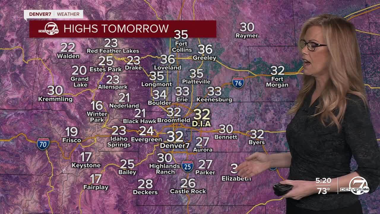
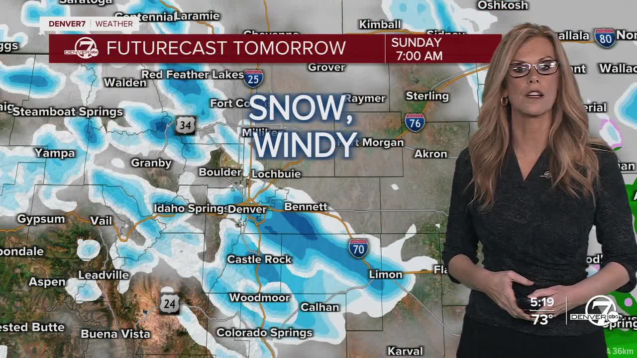
By Sunday morning, much colder conditions will take hold across the region. Temperatures will be more than 40 degrees colder than today, with highs only reaching the low 30s. Strong north winds will continue through the morning and afternoon, creating wind chills near zero across parts of the plains, especially east of I- 25. Snow on the plains will be light, generally under an inch, though blowing snow could briefly reduce visibility in stronger gusts. A High Wind Warning is in effect for Denver and eastern Colorado for Sunday- for wind gusts as high as 75 mph.
In the mountains, conditions will be much more severe tonight into early Sunday. Snow will develop this evening and become heavy at times overnight, with snowfall rates occasionally reaching 2 to 3 inches per hour. Combined with powerful winds, this could lead to whiteout conditions and dangerous travel across mountain passes through early Sunday morning. A Winter Weather Advisory is in effect for the northern and central mountains for up to 10" of snow through Sunday morning.
Snow will gradually taper off by Sunday afternoon, leaving most areas dry for the rest of the day. However, the cold and wind will linger through Sunday before slowly easing later in the day and into Sunday night as the storm system moves away from the region.
A major warmup will begin on Monday and continue into Tuesday as high pressure builds over the western United States. Temperatures will climb quickly from the 30s on Sunday into the 70s by Tuesday, and the warm pattern is expected to continue through the week. By mid to late week, temperatures could approach or even break daily records, with a chance that Denver challenges its all-time March high temperature of 84 degrees.
DENVER WEATHER LINKS: Hourly forecast | Radars | Traffic | Weather Page | 24/7 Weather Stream
