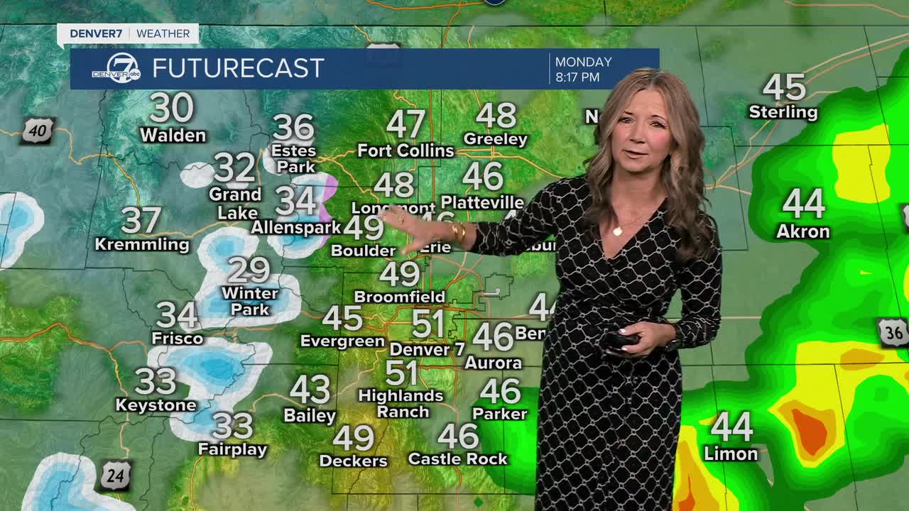


It's a quiet start to our Monday, but a cold front will race across the state Monday, bringing some chilly changes to the state!

You'll find mostly sunny skies this morning, with temperatures climbing into the low 60s by noon and upper 60s by 4 p.m. The winds will kick up throughout the day as the storm rolls through. We'll see gusts between 40 to 50 mph, with a slight chance of showers along the Interstate 25 corridor. There will be a better chance of showers across the eastern plains, with a couple of inches of snow in the northern mountains.
Temperatures will tank overnight. We'll see upper 20s to low 30s on the plains and teens in the mountains. The winds will remain gusty on Tuesday and it will be quite a bit colder. We'll see highs in the upper 40s to low 50s and those winds will make it feel even colder.
The rest of the week looks mild. From Wednesday through Friday, the weather should stay dry with near-normal temperatures in the mid to upper 50s. By next weekend, things will warm up again with sunshine and highs in the mid 60s to low 70s, perfect for spending some time outdoors.
DENVER WEATHER LINKS: Hourly forecast | Radars | Traffic | Weather Page | 24/7 Weather Stream
Click here to watch the Denver7 live weather stream.
