


DENVER — It finally felt a little more like winter today as Denver marked its first below-average day this month! The cooler air sticks around Friday before another spring-like warm-up next week.
Bundle up tonight! We're in for partly cloudy skies across the Front Range as temperatures plummet into the single digits and teens by morning.
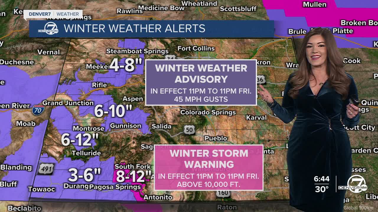
Meanwhile, the High Country will brace for another winter storm moving in overnight. This brings more heavy snow to the mountains along with tricky traveling conditions throughout the day Friday.
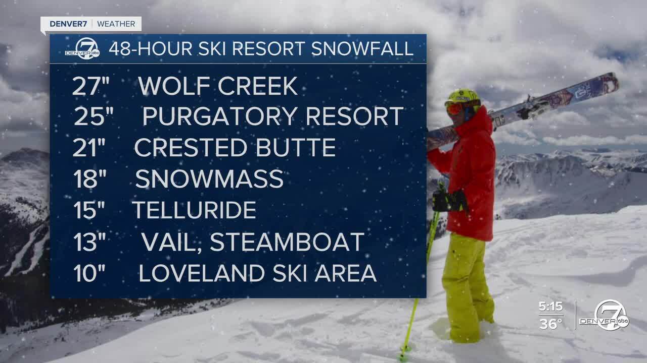
Here's a look at the 48-hour ski resort snowfall reports
Winter Weather Advisories go into effect again late tonight and continue through 11pm Friday for much of the High Country. It looks like about 4 to 12 inches of new snow will fall, depending on where you are in the mountains. This storm will wind down late Friday night, with bluebird skies on tap this weekend.
Here in the city, look for light snow showers throughout the day on Friday along the Interstate 25 corridor. It looks like less than an inch of accumulation around the Denver metro area. Keep your winter coats nearby! High temperatures stay chilly in the upper 20s to low 30s Friday afternoon.
Heading into the weekend, drier conditions return but temperatures will hold in the mid to upper 40s. So far, it looks like much warmer, above-average temperatures return by early next week.
DENVER WEATHER LINKS: Hourly forecast | Radars | Traffic | Weather Page | 24/7 Weather Stream
Click here to watch the Denver7 live weather stream.