


Tonight will stay quiet and fairly mild after a cooler afternoon, with just a few clouds drifting overhead and light winds settling in across the Denver metro. Temperatures will not drop as sharply as usual, setting the stage for a quick warm-up to start the workweek.

By Monday, a strong ridge of high pressure begins building across the region, pushing temperatures back into the low to mid 70s. Sunshine will dominate, and the warming trend will feel noticeable compared to the more seasonable conditions seen today.

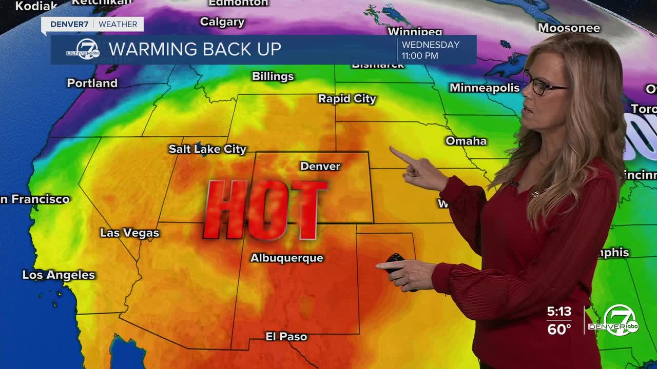
The heat ramps up significantly Tuesday and Wednesday, when record-breaking temperatures become likely. Highs are expected to climb well into the 80s, possibly approaching 90 degrees in some areas. There is a strong chance daily records will be broken, and even all-time March records could be challenged again.
Along with the heat, conditions will turn increasingly dry, bringing elevated to critical fire weather concerns across much of the region by midweek. Gusty winds and low humidity will combine with the unseasonably warm temperatures to create potentially dangerous fire conditions.
A shift arrives late in the week as a cold front attempts to move through, bringing a brief cooldown by Friday. Even so, temperatures will remain above normal, and another warming trend is expected heading into next weekend.
DENVER WEATHER LINKS: Hourly forecast | Radars | Traffic | Weather Page | 24/7 Weather Stream
Click here to watch the Denver7 live weather stream.
