


DENVER — The National Weather Service has issued a winter weather advisory for much of the urban corridor, including Denver, for Sunday afternoon and evening due to a brief but intense snowstorm moving through the area. Travel this evening will be difficult due to snow-covered roads.

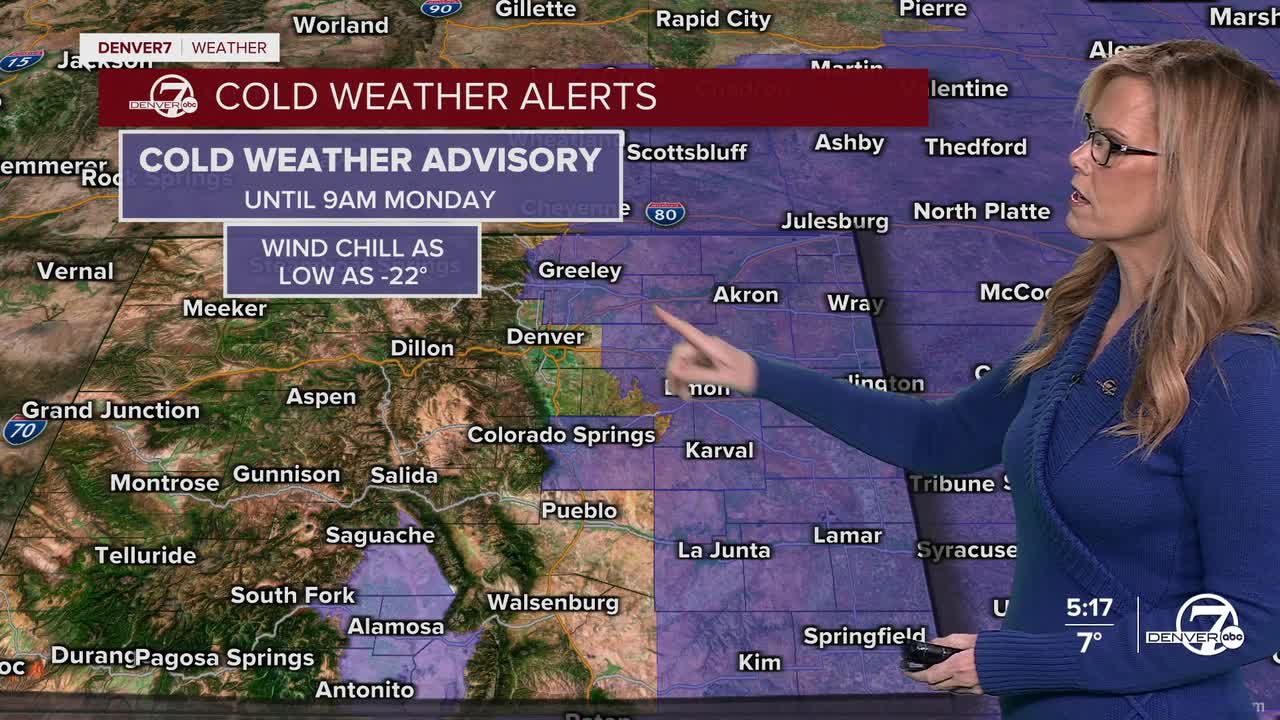
Very cold Arctic air will stay in place through Monday morning for Denver and the plains. Skies will be mostly clear for Sunday morning, which will allow temperatures to drop sharply. It wil be bitterly cold, with temperatures in the single digits or even below zero across the city, the plains, and the mountains. It will definitely feel harsh and wintry.

On Sunday, another surge of Arctic air will move into the area. Temperatures may briefly rise around midday, but they will fall quickly during the afternoon as the cold front arrives from the north. Clouds will increase, and snow showers will develop later in the day. Snow is expected across the urban areas and plains, with light but steady snowfall that could last several hours.

By Sunday afternoon and evening, snow will be driven by gusty winds, making it feel even colder. Even though the moisture in the air will be limited, the very cold temperatures will allow snow to pile up more efficiently. Many lower elevation areas could see around one to three inches of snow, while the foothills and mountains may receive higher totals. Roads could become slick during this time- especially after the Bronco game.

Sunday night into Monday morning is expected to be the coldest period so far this winter. Fresh snow on the ground and clearing skies will allow temperatures to plunge well below normal. Some locations could drop to around ten degrees below zero or colder. This will be dangerous cold, especially for anyone outdoors without proper protection.

On Monday, conditions will begin to improve. Winds higher in the atmosphere will push the Arctic air eastward, allowing temperatures to rebound closer to normal for this time of year. Skies will dry out, and each day next week will gradually get warmer. By midweek, highs may return to the low 50s, with mostly dry weather expected after the early-week cold snap.
DENVER WEATHER LINKS: Hourly forecast | Radars | Traffic | Weather Page | 24/7 Weather Stream
Click here to watch the Denver7 live weather stream.
