


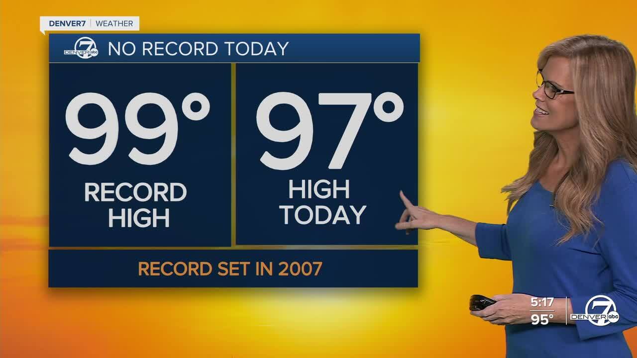
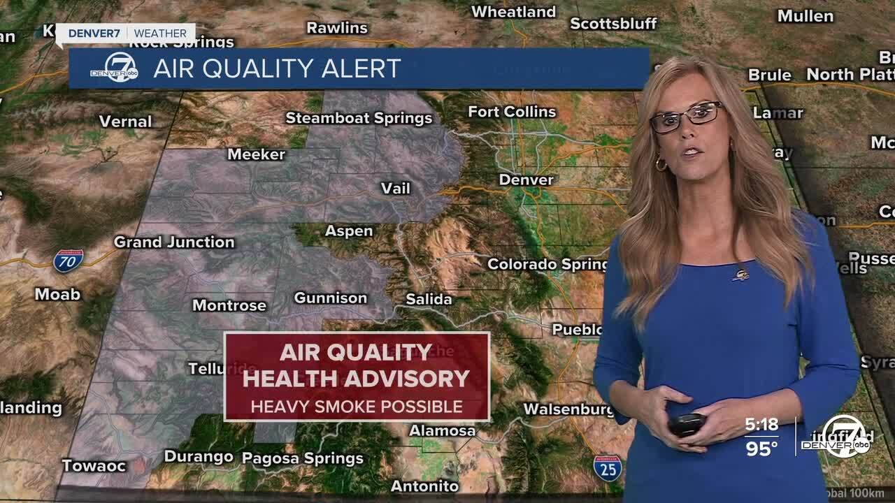
DENVER — Afternoon highs for the Front Range made it into the upper 90s and triple digits Wednesday. The near record heat will stick around for 1 more day- before things cool down. We’re also watching for some elevated smoke, especially if wildfires flare up to the west, but for now, any smoke should stay higher up in the atmosphere and not cause major visibility issues at ground level.
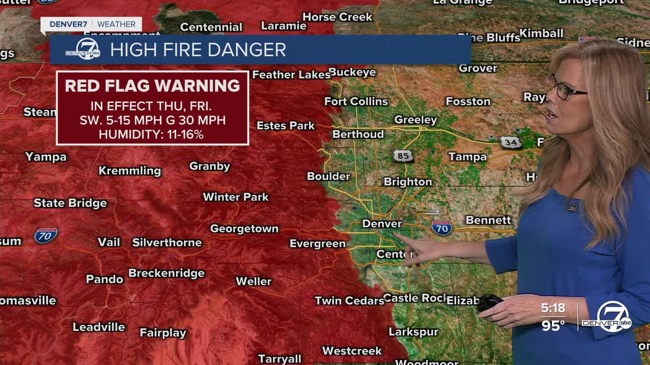
Thursday is shaping up to be the hottest day of the week, and possibly one for the record books. Temperatures will rocket into the upper 90s across the plains, and there’s even a small chance Denver could hit 100°. The heat will arrive fast, with many areas already in the 90s by mid-morning. On top of the scorching temperatures, dry thunderstorms could form by the afternoon. These are storms that bring little rain but a lot of lightning and gusty winds, perfect conditions for new wildfire starts. Winds from collapsing storm cells could reach 40–50 mph in some areas. Because of the chance for lightning, fire danger is now higher to the west of Denver.
On Friday, a small uptick in moisture should help reduce the dry lightning risk a bit, and there’s a better shot at scattered storms, especially in the mountains. The plains will still be hot, but just a couple degrees cooler than Thursday. Most areas can expect a mix of sunshine, clouds, and the occasional rumble of thunder in the afternoon and early evening hours.
Saturday looks very similar to Friday, still warm, but not quite as extreme as Thursday. Storm chances will stick around, especially over higher terrain, but showers will likely be more scattered and brief for folks east of the Front Range. Temperatures will stay a few degrees above average, but you’ll probably notice the slight cooldown compared to earlier in the week.
By Sunday into early next week, things start to dry out again. Storm chances drop a bit, although a few could still pop up east of the foothills in the afternoons. The pattern shifts slightly by midweek, but unfortunately it doesn’t bring much relief. We’ll stay locked in to above-normal temperatures, with limited chances for significant rain. The heat might not be as intense as Thursday, but it's not going away anytime soon.
DENVER WEATHER LINKS: Hourly forecast | Radars | Traffic | Weather Page | 24/7 Weather Stream
Click here to watch the Denver7 live weather stream.
