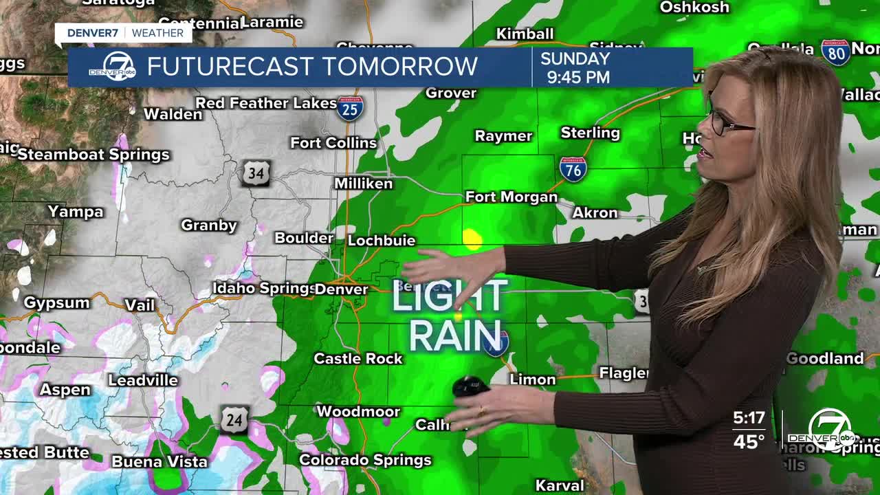


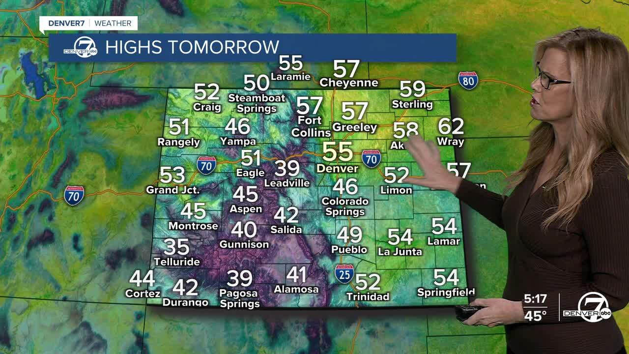
On Sunday, another round of light precipitation is possible as an upper-level low moves across southern Colorado. The best chances for rain or snow will be south and east of Denver, while areas northwest of the metro may see very little. Snow levels should hover around 7,000 feet, meaning light snow in the mountains and light rain elsewhere. Most of what falls should stay on the lighter side. We'll see heavier snow across the southwestern mountains.

A winter weather advisory goes into effect on Sunday morning for the San Juans in SW Colorado where we could see another 2 to 8 inches of snow by Sunday night. It'll be a nice change for the mountains near Durango and Telluride!
Monday and Tuesday will bring a noticeable change near Steamboat Springs as a fast-moving system sweeps in from the Pacific Northwest. Expect increasing winds, possibly strong at times, and colder temperatures. Snow chances pick up in the northern mountains Monday night, but conditions should gradually improve by Tuesday as the system moves out. Skies on Monday will be clearing for the Denver area and temperatures will stay pretty mild.
Heading toward Thanksgiving, the weather looks to settle down. Winds will ease, temperatures will moderate and we'll actually see some pretty seasonal condition on Thanskgiving. It will be a cold start that morning, but we'll see some sunshine and a nice warm up during the Mile High United Way Turkey Trot! Highs in the low to mid-50s on Thursday afternoon.
By the weekend after Thanksgiving, another storm moves in and brings colder air and the first chance of snow for metro Denver. Nothing is set in stone, but be aware that travel home from Thanksgiving may include high temperatures in the 20s and snow for the Front Range.
DENVER WEATHER LINKS: Hourly forecast | Radars | Traffic | Weather Page | 24/7 Weather Stream
Click here to watch the Denver7 live weather stream.
Denver7 live 24/7 weather stream
DENVER WEATHER LINKS: Hourly forecast | Radars | Traffic | Weather Page | 24/7 Weather Stream
Click here to watch the Denver7 live weather stream.
