


DENVER — After a record-tying high of 68 degrees in Denver on Monday, it's going to be another unseasonably warm day along the Front Range. We'll see a mix of sun and clouds Tuesday morning, with 40s and even a few 50s for the early morning drive.

Temperatures will climb into the low 60s by lunch and mid to upper 60s by 3 p.m. It will be about 20 degrees above normal and just five degrees cooler than Tuesday's record high.
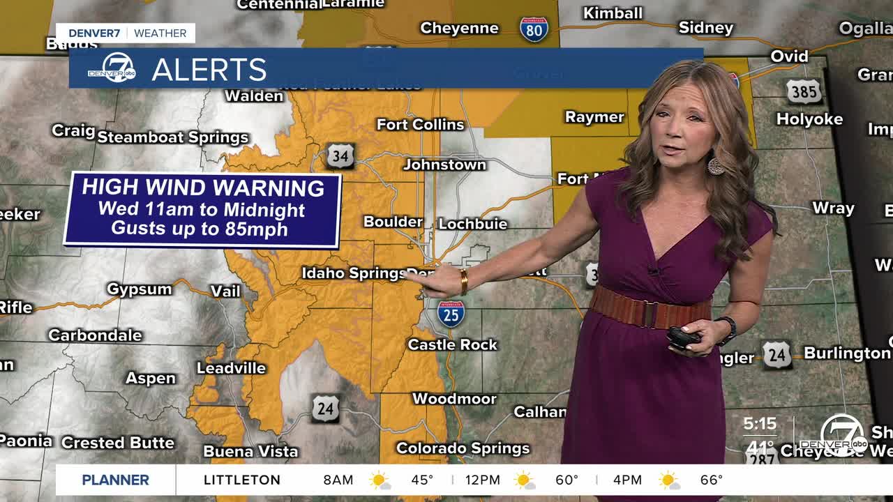
Wednesday brings the biggest impact of the week as a cold front races through the state with different concerns, including damaging winds, mountain snow and possible rain on the plains.
The National Weather Service in Denver has issued a Red Flag Warning for the Front Range Foothills, Denver metro area, and portions of Weld, Adams and Arapahoe counties. It's in effect from 11 a.m. to 6 p.m. on Wednesday. Relative humidity will drop as low as 15%, with highs in the 60s.
There's also a High Wind Warning for the northern Front Range mountains for gusts up to 85 mph.
Winds become more widespread on Wednesday night into Thursday, bringing impacts to lower elevations as well.
Light snowfall may develop in the mountains on Wednesday, while rain chances are possible along the metro and Eastern Plains. This system is expected to bring cooler temperatures on Thursday with highs in the upper 40s and low 50s.
Friday through the weekend, warmer temperatures return for lower elevations.
DENVER WEATHER LINKS: Hourly forecast | Radars | Traffic | Weather Page | 24/7 Weather Stream
Click here to watch the Denver7 live weather stream.
