


Starting tonight, expect mostly quiet weather with increasing high clouds moving in. It’ll stay mild for early February, with overnight temperatures running warmer than normal thanks to those clouds and a generally calm setup. Winds stay fairly light overnight, so overall it should be a pretty uneventful night weather-wise.
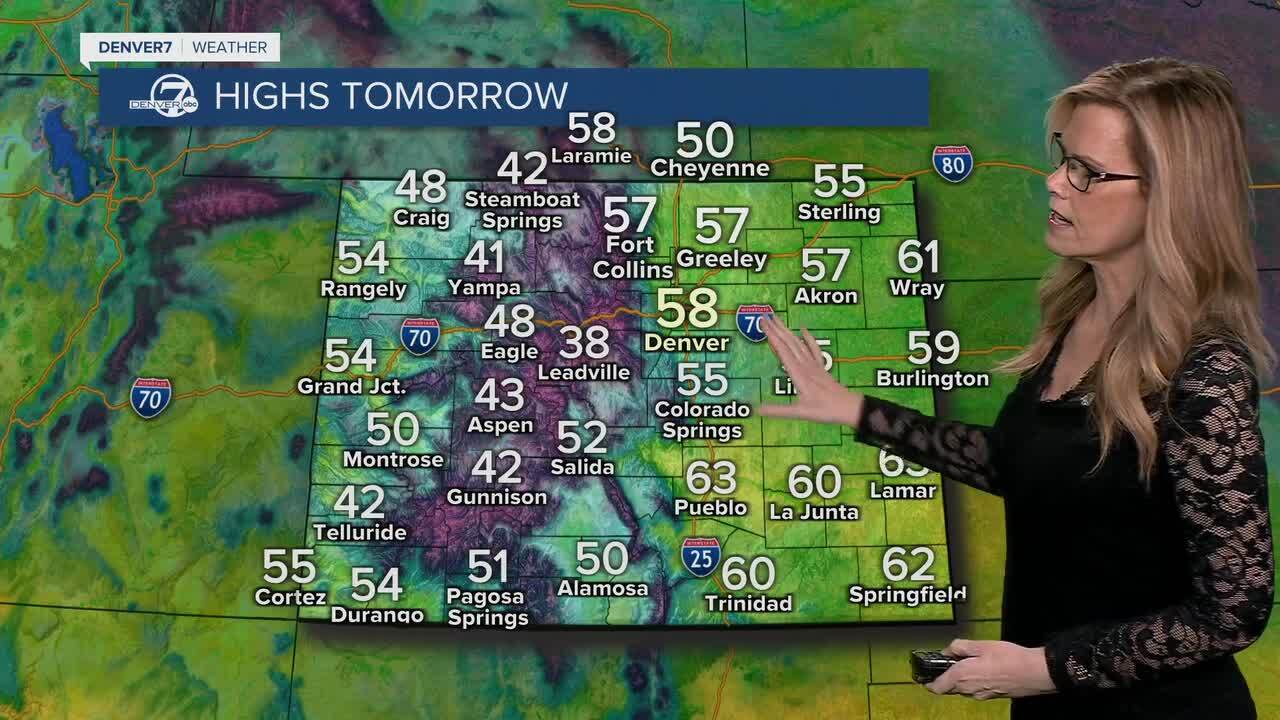
On Monday, clouds will hang around through the morning, and a weak cool front will slide through from north to south. This isn’t a sharp cold snap, but you will notice cooler temperatures compared to today, with highs settling into the 50s. Northeasterly winds will pick up behind the front, with occasional gusts around 20 to 25 mph before easing later in the day.
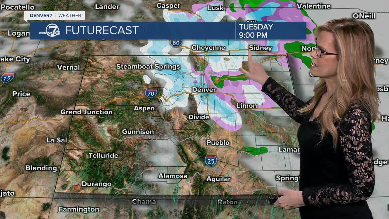
Tuesday cools down a bit more, with highs mainly in the upper 40s to mid-50s under northwest flow aloft. By Tuesday night into early Wednesday, a passing weather system brings the next chance for snow, though confidence isn’t especially high for the metro area.
If snow does develop, it looks light, with the best odds focused on the mountains and the Palmer Divide, and only spotty flurries possible elsewhere.Any lingering light snow or flurries early Wednesday should end fairly quickly as skies clear out. Temperatures will stay on the cool side, but still seasonable, with highs generally in the mid-40s to lower 50s.
By later in the day, sunshine should return as drier air moves back in.From Thursday through next weekend, the pattern turns warm and dry. A strong ridge of high pressure builds over the region, pushing temperatures back up into the upper 50s and mid-60s. Aside from maybe some passing high clouds at times, the end of the week and the weekend look quiet, mild, and precipitation-free.
DENVER WEATHER LINKS: Hourly forecast | Radars | Traffic | Weather Page | 24/7 Weather Stream
Click here to watch the Denver7 live weather stream.
Denver7 live 24/7 weather stream
DENVER WEATHER LINKS: Hourly forecast | Radars | Traffic | Weather Page | 24/7 Weather Stream
Click here to watch the Denver7 live weather stream.
