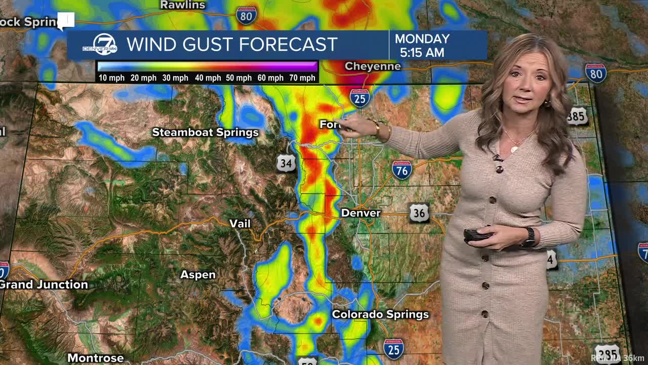


DENVER — It's going to be a pretty mild start to the week, but we are in for some really windy conditions across parts of Colorado within the next 24 to 36 hours.

You'll find mostly sunny skies for the early morning drive in Denver. Temperatures are in the 30s on the plains, with teens and 20s in the mountains. The high country snow has lightened up, but we'll see more off and on again snow through the end of the week.
One of the biggest issues will be gusty winds. It's windy Monday morning in the mountains and those winds are only going to get stronger. A High Wind Watch watch goes into effect Monday night for the northern Front Range mountains and foothills. The watch includes Rocky Mountain National Park, Berthoud Pass and the Eisenhower Tunnel. We'll see gusts near 80 mph, with areas of blowing snow and likely even more power outages.
It will be breezy in Denver, but windier west of Interstate 25 and closer to the foothills. Temperatures will soar to near 50 degrees in Denver today and it will be even warmer through midweek. We'll see highs near 60 degrees on Tuesday, Wednesday and Thursday.
Another round of spotty rain or snow showers is possible for the metro late Thursday into Friday, but this week's forecast is looking mostly dry as we approach mid-December.
DENVER WEATHER LINKS: Hourly forecast | Radars | Traffic | Weather Page | 24/7 Weather Stream
Click here to watch the Denver7 live weather stream.
