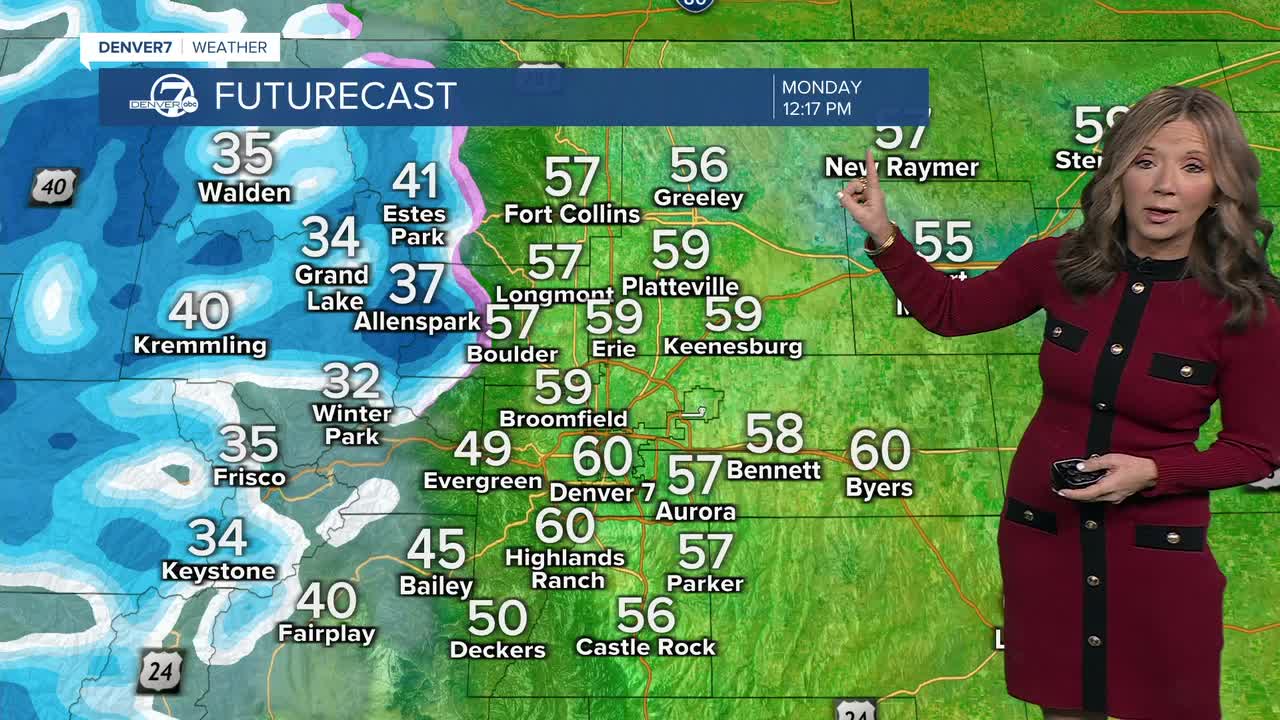


DENVER — It will be a gorgeous start to the week. We'll see mostly sunny skies, with 30s Monday morning but another afternoon of 60s for the Eastern Plains. Monday will be about 15 to 20 degrees above normal for early January.

You'll find dry and breezy conditions across the Eastern Plains, but cold and snowy weather over the western half of the state. The heaviest snowfall is expected over the Park Range — areas like Rabbit Ears Pass could see just over a foot of snow by early Tuesday.
A Winter Weather Advisory is in effect in effect across northwestern Colorado until early Tuesday for around 6 to 14 inches of snow. Skies will gradually clear out on Tuesday!
Lower elevations, including the plains and the Interstate 25 corridor, will stay dry through midweek. However, it will become breezy again Monday afternoon and again on Tuesday. We'll see gusts between 20 to 30 mph.
Even with the breeze, temperatures will remain mild for this time of year, reaching the upper 50s to lower 60s both Monday and Tuesday.
Fire weather conditions will become elevated again Monday and Tuesday due to the dry air and gusty winds. While conditions may approach concerning levels, temperatures will cool just enough to keep the fire danger below critical levels. Wednesday looks quieter overall, with lighter winds, mild temperatures, and only a small chance of light mountain snow.
Looking ahead to Thursday and Friday, colder and more unsettled weather is expected to return. There is still some uncertainty, but temperatures will be cold enough for snow if precipitation develops, and at least light snowfall is possible across parts of the region. This pattern shift will bring a more wintry feel to end the week.
DENVER WEATHER LINKS: Hourly forecast | Radars | Traffic | Weather Page | 24/7 Weather Stream
Click here to watch the Denver7 live weather stream.
