

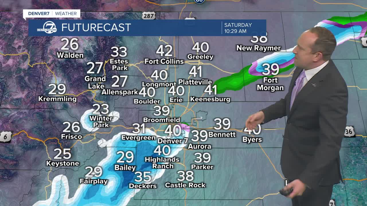



DENVER — Snow has been the big story this morning, with the city of Denver seeing its first snowflakes of the season. In the downtown area, it has primarily been a wintry mix, keeping roads wet, rather than snowy. In the foothills, some areas have seen heavier bursts of snow, resulting in light accumulations on grassy surfaces and some roads. Bands of heavy snow have brought several inches to Red Rocks.
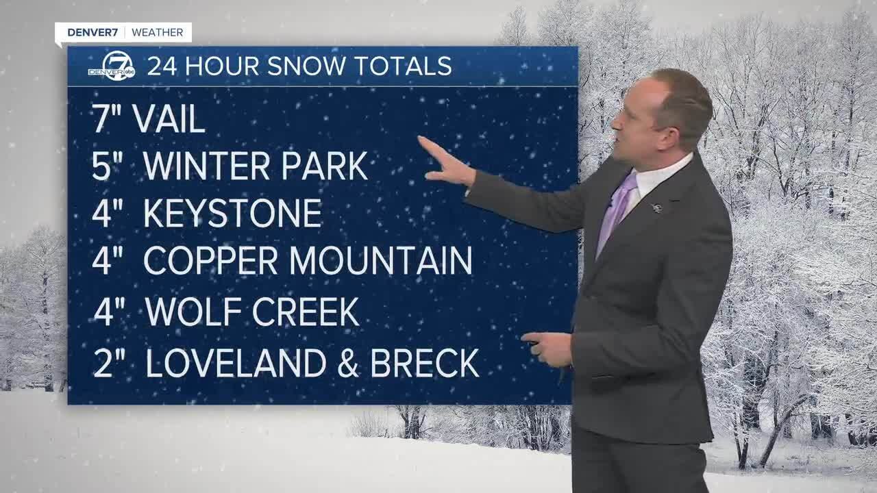
Where we have seen some disruptions to travel has been in the foothills and mountains. Accumulations here have been in the 3-7" range, with some fresh powder this weekend for skiers and boarders.
Wintry precipitation should come to an end by late morning to early afternoon, leaving us quite chilly into the afternoon. Highs today will only warm into the lower to middle 40s.
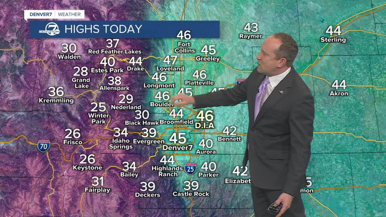
Lows tonight will be the coldest of the month, dropping down to the upper 10s and 20s.
Sunday's weather will be chilly, but nice, with highs in the 40s. Skies will remain dry throughout the day ahead of our next storm early next week. This storm looks weak, with light snow showers expected in the mountains by Monday afternoon and evening. Totals in the high country look to be in the 1-3" range. As the system ejects east Tuesday morning, there may be a few flurries that reach Denver. Otherwise, we should see very little impact from this storm in metro Denver.
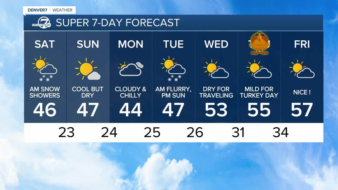
High pressure looks to bubble up from the southwest starting on Wednesday, taking highs in the 40s from Monday and Tuesday to the 50s for the back half of the week.
DENVER WEATHER LINKS: Hourly forecast | Radars | Traffic | Weather Page | 24/7 Weather Stream
Click here to watch the Denver7 live weather stream.
