


DENVER — Starting tonight, skies will stay clear well into the overnight hours. Temperatures overnight will be cool but comfortable, setting us up for a warm and pleasant Friday.
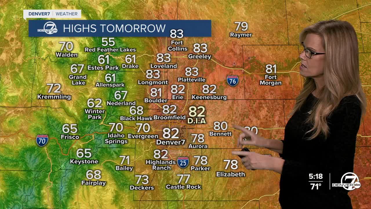
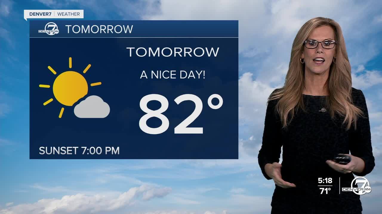
Friday brings a return to drier and more seasonal weather, with daytime highs creeping back up to where we’d expect them for mid-September. You might see a few clouds drifting in from the southwest, and a bit of afternoon cumulus over the higher terrain, but for most areas, it’ll be a sunny and mild day—great weather to enjoy some time outside.
Heading into the weekend, temperatures will stay near average, and a bit more mid-level moisture starts to sneak in. That’ll lead to a small chance for afternoon showers or storms, especially in the mountains. Most of the activity will stay in those higher elevations, though folks in nearby foothill areas might catch a brief shower or rumble of thunder.

Changes start to arrive on Monday as a cold front pushes into the region. It won’t be a major storm system, but it will bring a modest increase in showers—mainly Monday afternoon into the night. Temperatures will take a noticeable dip behind the front, dropping 15 to 20 degrees between Sunday and Tuesday, with highs feeling much cooler early next week.
By Tuesday and Wednesday morning, there’s even a small chance for some spotty frost in the coldest parts of the plains if skies clear and winds stay light overnight. Most places will just see lows in the 40s, so nothing too harsh. After that brief cool-down and small chance for rain, the pattern looks to dry out again with gradually warming temperatures returning mid-to-late next week.
DENVER WEATHER LINKS: Hourly forecast | Radars | Traffic | Weather Page | 24/7 Weather Stream
Click here to watch the Denver7 live weather stream.
