


DENVER — It's the calm before the next wind storm blasts Colorado! Look for mostly clear skies tonight as temperatures dip into the upper 20s to low 30s around the Denver metro area. Winds will start to kick up in the mountains and foothills overnight with stronger gusts on the way Thursday.
A powerful downsloping wind event is expected to form along the Front Range mountains and foothills, where wind gusts could exceed 80 to 90 mph in some higher elevation areas. A High Wind Warning is in effect for these areas through noon on Friday.
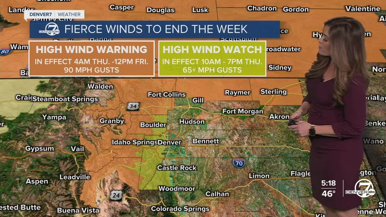
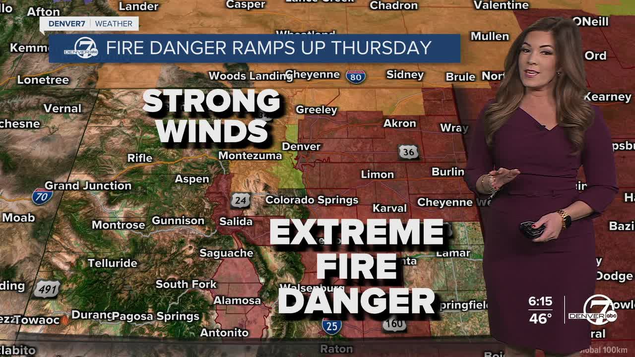
A High Wind Watch is in effect for the western side of the metro area for gusts up to 65 mph. These strong winds combined with very low humidity will lead to dangerous fire weather conditions. Parts of the nearby plains and urban corridor will also see gusty conditions, with winds potentially reaching 35 to 50 mph.
A Red Flag Warning is in effect for the entire Interstate 25 corridor stretching across the far eastern plains from 11am to 9pm Thursday. If we see a spark, it could send flames flying fast so please be careful outdoors.

On Friday, winds may ease slightly but conditions will remain warm, dry and breezy. This means the risk for fires will stay elevated across much of the plains, urban corridor and lower foothills. Even though the strongest gusts may not be as intense as Thursday, the air will stay very dry, allowing critical fire weather conditions to continue.
Another round of stronger winds is expected on Saturday as the jet stream dips south and strengthens the downsloping flow again across Colorado. Temperatures in the mid 70s, strong winds and low humidity values will once again support widespread fire danger. By late Saturday, however, a strong cold front will begin moving into the region, bringing a shift in the weather pattern.
As the cold front arrives Saturday night, snow will begin developing in the mountains and will continue into Sunday. It looks like the Denver metro and plains will see a few scattered snow showers on Sunday with some light accumulation. Temperatures will turn noticeably cooler on Sunday, back into the upper 30s to low 40s, before warming up again early next week.
DENVER WEATHER LINKS: Hourly forecast | Radars | Traffic | Weather Page | 24/7 Weather Stream
Click here to watch the Denver7 live weather stream.
