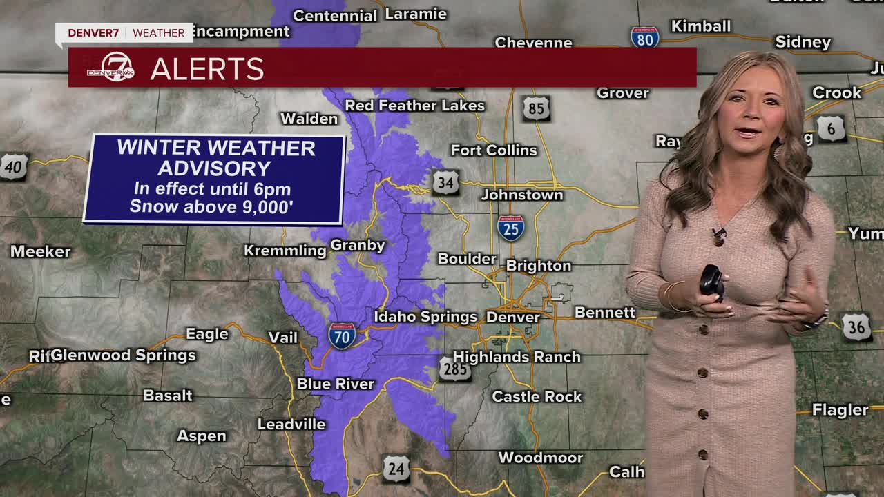


DENVER — It's the first full day of fall, but in some parts of Colorado it feels more like winter! A storm rolling through Colorado Tuesday will bring rain to the plains and some snow to the mountains above 9,000 feet.

Snow continues to fall across the northern Front Range mountains where a Winter Weather Advisory remains in effect until 6 p.m. Tuesday. Snowfall totals will likely be around 4 to 10 inches by late Tuesday night across parts of Rocky Mountain National Park.
Mountain passes, such as Berthoud Pass, Cameron Pass, and the approach to the Eisenhower/Johnson Tunnels could pretty slushy. We'll see wet roads across the plains as more rain develops throughout the day.
Temperatures will be about 20 to 25 degrees cooler than yesterday, with highs in the 50s. Overnight lows tonight will dip into the 40s on the plains and 20s to 30s in the mountains.
Skies will quickly clear out tonight and we're in for some warmer and drier weather for the rest of the week. We'll see highs near 70 degrees, with plenty of sunshine on Wednesday.
Sunshine and milder temperatures are expected to hold through most of the week, with the next real chance of precipitation not showing up until late in the weekend — if at all.
DENVER WEATHER LINKS: Hourly forecast | Radars | Traffic | Weather Page | 24/7 Weather Stream
Click here to watch the Denver7 live weather stream.
