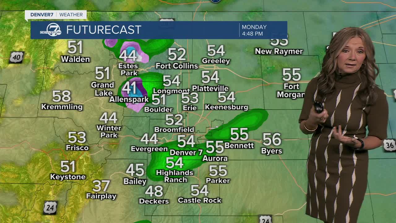


DENVER — It will be a cool and soggy start to the week in Denver. You'll find some drizzle for the early morning commute, with temperatures dipping into the 40s early on.
The rain switched over to snow in the mountains and there are some icy conditions in the high country where temperatures have dipped into the upper 20s and low 30s.

The clouds will linger across the eastern half of the state and we'll see a few more showers develop this afternoon. We'll see wet roads for the evening commute, with highs in the 50s. Today will be the coolest and wettest day of the week.
If you’re heading up to places like Cameron Pass or Trail Ridge Road, be prepared for winter driving conditions, as several inches of snow fell overnight and we're seeing some slick and slushy conditions over those high mountain passes. A few more mountain rain and snow showers are possible this afternoon and evening.
Clouds will likely hang on through Monday night, which should help keep temperatures from dropping too low overnight. We'll see areas of patchy fog early Tuesday morning, but skies will quickly clear across the northern Front Range by Tuesday afternoon. Temperatures will also be about 10 degrees warmer, with mid- to upper 60s by Tuesday afternoon.
By Wednesday, we’ll see sunshine and noticeably warmer temperatures returning — highs should be several degrees above average and continue that way into the weekend. It’ll be a nice stretch of fall weather with dry conditions for most areas, though there’s a small chance of mountain showers by Friday or Saturday. Enjoy the warm-up while it lasts!
DENVER WEATHER LINKS: Hourly forecast | Radars | Traffic | Weather Page | 24/7 Weather Stream
Click here to watch the Denver7 live weather stream.
