


Cloudy, soggy skies will sit over the Front Range overnight as snow falls in the mountains and light rain continues on the plains.
Around the I-25 corridor and metro areas, look for a few lingering rain showers, though a few wet snowflakes could mix in overnight above 6,000 feet.
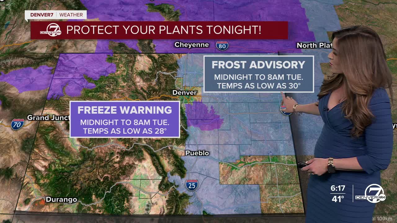
Protect your pipes, plants and pets overnight! We're in for one last spring freeze for much of the plains as temperatures fall close to or just below freezing. Whether it gets cold enough in the cities will depend on how quickly skies clear and winds calm down, but colder rural areas have a better chance of dipping below freezing overnight. A Frost Advisory is in effect until 8am Tuesday for areas north and east of Denver. A Freeze Warning continues for parts of Douglas, Elbert and El Paso counties as lows could drop into the upper 20s by Tuesday morning.
It'll be another cool and cloudy day with highs in the upper 40s to low 50s along I-25 Tuesday afternoon. Another round of heavy rain will roll into the Denver metro area around 4pm and continue into the evening hours. The Front Range mountains will get another quick blast of snow!
Look for highs in the low 60s Wednesday with upper 60s Thursday along with scattered showers and storms. Temperatures rebound into the lower 70s Friday and continue to warm into Memorial Day weekend. We'll be in the low 80s under partly sunny skies on Monday - a gorgeous day to be outside!

DENVER WEATHER LINKS: Hourly forecast | Radars | Traffic | Weather Page | 24/7 Weather Stream
Click here to watch the Denver7 live weather stream.
