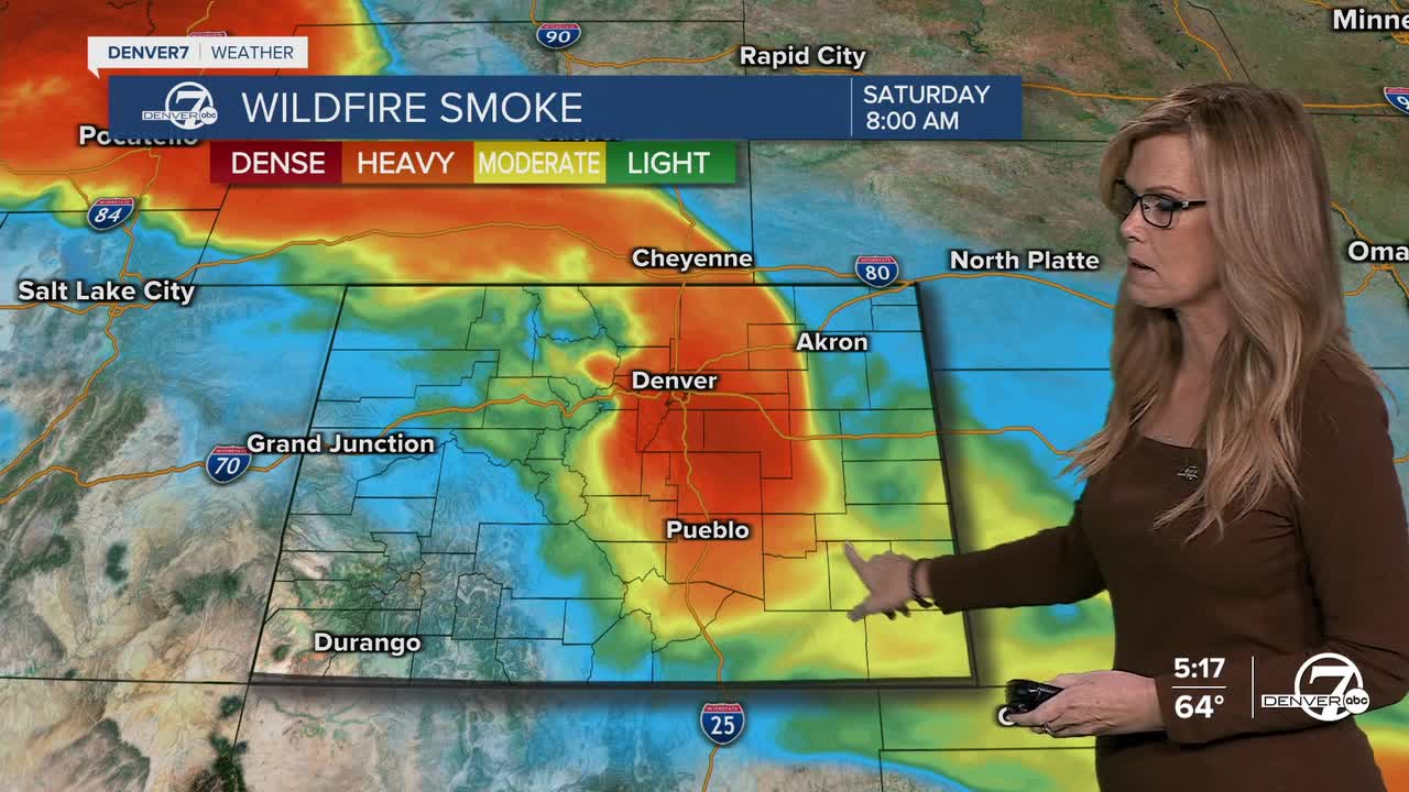


DENVER — Tonight, it’ll still be pretty hazy and smoky across northern Colorado and the Front Range. That smoke is coming from wildfires up in the Pacific Northwest and Canada, and it will stick around through Saturday. It’ll stay a bit cool tonight thanks to the clouds and smoke.
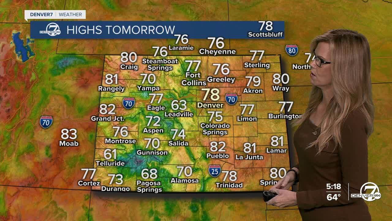
On Saturday, not much changes. We’ll still be dealing with some haze and smoke. Temps will warm up a little, with most spots reaching the mid to upper 70s. Like today, scattered showers and storms are possible in the afternoon and evening, but again, mostly in the higher terrain. If you're down on the plains or in the city, it’ll likely stay dry.
Sunday brings a better chance of storms reaching more areas, including the plains. It’ll also be warmer, with highs in the low to mid 80s. The atmosphere will be a bit more unstable, meaning some of those afternoon and evening storms could pack more of a punch. So, if you’ve got outdoor plans (like the Bronco game), keep an eye on the sky later in the day.

Looking into next week, we’re expecting warmer and drier weather. High pressure will move over Colorado, pushing highs into the 80s across most of the state. There could still be a few afternoon showers or storms in the mountains, but most places will stay sunny and dry from Monday through Thursday.
By Friday and next weekend, we might see a shift. Some forecast models are hinting at a system moving into the Southwest, which could bring in more moisture. That would mean cooler temps and a better shot at rain, but it’s still early to say for sure. For now, enjoy a warm, mostly dry week after the weekend!
DENVER WEATHER LINKS: Hourly forecast | Radars | Traffic | Weather Page | 24/7 Weather Stream
Click here to watch the Denver7 live weather stream.
