


DENVER - Look for a few lingering storms across the plains tonight. Otherwise, we'll see partly cloudy skies and temperatures falling into the upper 50s to low 60s overnight.
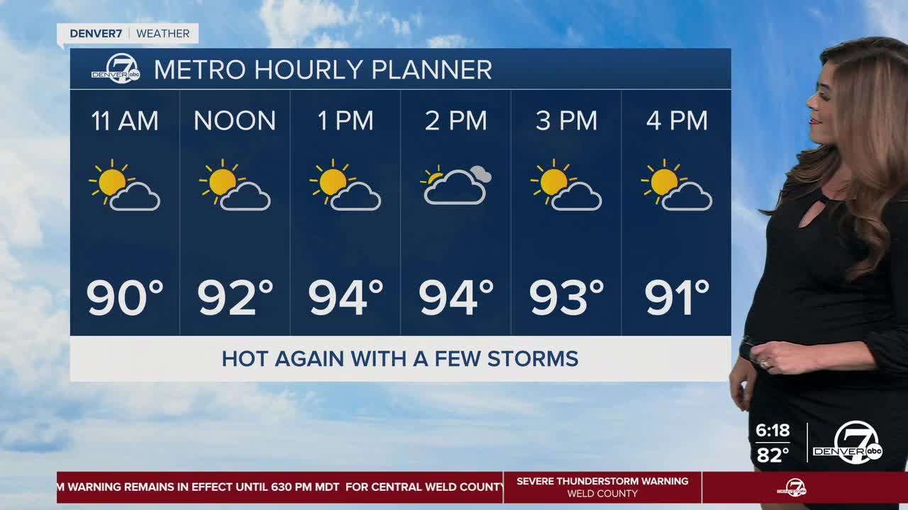
It'll be hot again on Tuesday with highs skyrocketing into the mid- to upper 90s by the afternoon. If you’re spending time outside, just be sure to take breaks, drink plenty of water, and find some shade when you can.
We'll see some hazy sunshine early on, with a chance of thunderstorms in the afternoon. Even if it doesn’t rain in your area, storms could send out strong gusty winds -those sudden blasts that kick up dust and knock over lawn chairs. While we aren't expecting any severe storms around the Denver metro area, some stronger storms are possible over the northeastern plains Tuesday.
Wednesday brings some big weather changes. A cold front is expected to move through, which will cool things off a bit and increase our chances for more widespread rain. Storms could be more active across both the mountains and plains, so plan on a higher chance of getting wet that day. And a few storms could turn severe along I-25 and along the E. Plains.
By Friday, the heat will start to creep back in, with temperatures climbing back into the 90s and the usual pattern of afternoon storms returning. It won’t be a total washout over the weekend but storm chances will continue each day. Keep your umbrella or rain jacket nearby just in case something drifts over your area in the afternoon or evening!
DENVER WEATHER LINKS: Hourly forecast | Radars | Traffic | Weather Page | 24/7 Weather Stream
Click here to watch the Denver7 live weather stream.
