


DENVER — If Tuesday’s rain showers made your heart sing, we’ve got good news: More rain is coming. The better news? It could turn out to be the wettest week for the Denver metro since September, according to weather forecasters.
Scattered showers and isolated thunderstorms will continue through Wednesday evening, mainly around the Palmer Divide and east central Colorado, before a stronger system along with a cold front moves in Thursday morning.
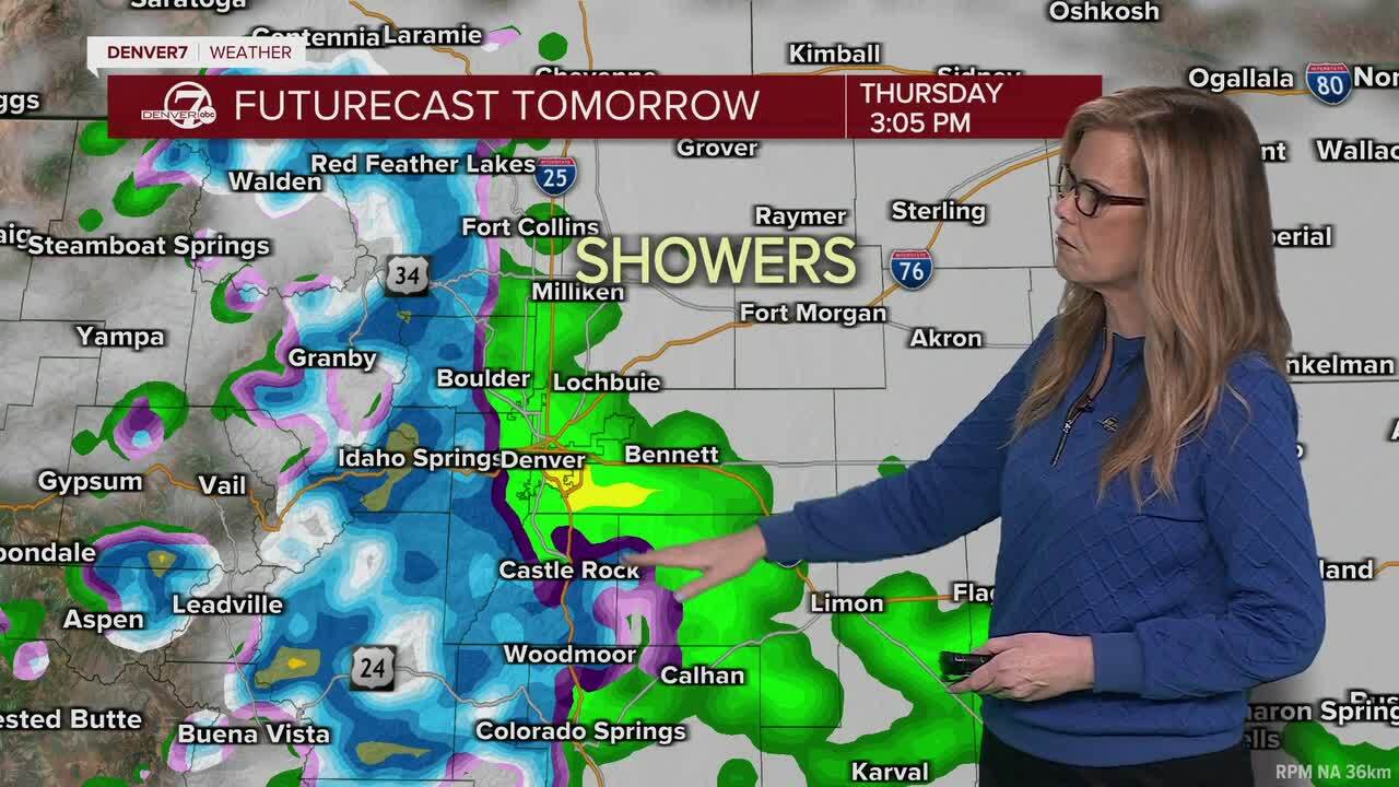
Watch the latest forecast from Denver7 meteorologist Stacey Donaldson in the video player below:
That weather pattern will usher in snow for the mountains and widespread rain to the plains. How much? Forecasters with the National Weather Service in Boulder were cautious to provide a definitive answer by Wednesday afternoon, but if the system holds and conditions are favorable, Denver could pick up about a half inch of rain as showers linger into the overnight hours of Friday, according to Denver7 chief meteorologist Lisa Hidalgo.
“More rain on the way here along the Front Range and then, potentially, even some snow by early [Thursday morning] around the Palmer Divide,” Hidalgo said, adding that areas like Elizabeth, Kiowa, east toward Limon and south toward Colorado Springs could see rain switch to snow.
Widespread rain and soggier, cooler conditions will continue throughout Thursday with the mountains, foothills, and the Palmer Divide likely seeing more precipitation.
“For Denver, we could see amounts as low as a couple tenths, or as high as 1 inch,” NWS forecasters said, warning that different weather models were producing different results. “Therefore, we still have a lot of uncertainty regarding precipitation amounts and we`ll be somewhat conservative by leaning toward the lower end of [the] guidance, especially east and north of Denver.”
If that storm system doesn’t move closer north to the metro, Denver could potentially see between a quarter to a little more than half inch of precipitation by the time the storms are over Friday. Any rain that falls will favor the western and southern suburbs, forecasters said.
Check the latest Colorado winter weather alerts
“Fort Collins, Greeley, and the northeast plains will likely struggle to see much in the way of beneficial precipitation as there’s currently a pocket of drier air in southeast Wyoming, and that gets transported slightly southward through the next 24 hours,” NWS forecasters said.
Weather service officials said the mountains are looking at several inches of snow with this storm system. Conditions have prompted the agency to issue a winter weather advisory for the Front Range Mountains and South Park through Thursday night. Between 5-13 inches of much-needed snow could fall above 9,000 feet, they said.
The NWS said in its forecast discussion Wednesday that snow levels will mostly range between 6,500-7,000 feet, with the occasional snowflake mixing in down to about 5,800 to 6,000-feet.
“Thus, higher elevations of the Palmer Divide near Monument may also see a few inches of slushy snow by Thursday night but almost all of Denver metro should stay snow free,” forecasters wrote.

Rain showers will wind down late Thursday night, but a few showers are likely to continue through Friday, especially in/near the foothills and Front Range mountains, they said.
“As that system clears out, sunshine and warmer weather move back in for the first weekend of May,” with highs in the upper 60s Saturday with mid-70s on tap Sunday, Hidalgo said earlier Wednesday.
Weather service officials said showers could return by Monday and Tuesday, with models showing a trend toward a wetter period late Tuesday into Wednesday.
Click here to watch the Denver7 live weather stream.