


DENVER – Gusty winds combined with dry conditions and above normal temperatures will create widespread critical fire weather across the Eastern Plains and parts of the Denver metro area Friday ahead of potential rain and snow showers that will be the forthbringer of high and potentially damaging winds this weekend, according to forecasters with the National Weather Service in Boulder.
This insane weather trifecta begins Friday at 10 a.m., when a red flag warning goes into effect for most of the plains east of I-25 through 9 o'clock Friday night. Southerly winds are expected to increase throughout the day with sustained winds 25 to 35 mph and gusts up to 50 mph possible, weather service officials said Thursday. Relative humidity values will be as low 7%.
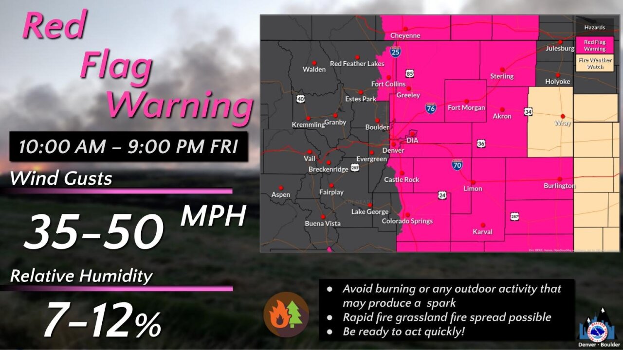
“Conditions will be favorable for rapid fire spread,” weather service officials said, adding the combination of strong winds, low relatively humidity, and warm temperatures “can contribute to extreme fire behavior.”
NWS officials advise people avoid “any activity that may produce a spark and start a wildfire.” Outdoor burning of any kind is strongly discouraged and people are also advised not to throw cigarette butts out the window in areas under the red flag warning.
Possibility of rain and snow showers Saturday
Warm and dry conditions will subside Friday as a “potent storm” brings Pacific moisture into Colorado, though it’s not yet clear how much impact it’ll have for those us in the Denver metro.
“While mountain snowfall is likely, at this point, uncertainties still remain on the track of the upper level low as it shifts eastward across CO, which will effect (sic) what takes place on the plains,” forecasters said in their latest forecast discussion.
As it stands now, the models “continue to show slight differences,” forecasters said.
The system, they wrote, "could bring another round of snow for the mountains and maybe some more moisture to the plains. Low confidence remains this far out and updates will come as more details develop."
Saturday’s high is expected to dip by 26 degrees from Friday’s high of 75, reaching only 49 degrees. So those heading to the Rockies game should be weather ready.
High, potentially damaging winds possible starting Saturday into Sunday
Starting as early as Saturday morning and lasting through Saturday night before gradually improving by Sunday, portions of central, east central, north central and northeast Colorado will be under a high wind watch as westerly winds between 35 to 45 mph reach gusts of up to 75 mph possible. Localized gusts of up to 100 mph are also in the cards, according to weather service officials in Boulder.
Those areas include everything east of Vail and Buena Vista, the whole Denver metro area, all the way east to Julesburg and Holyoke in the Eastern Plains, forecasters said.
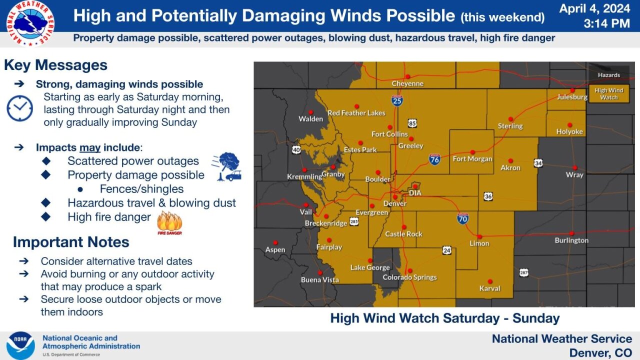
“Damaging winds could blow down trees and power lines. Widespread power outages are possible,” forecast officials wrote in Thursday’s warning. “Travel could be difficult, especially for high profile vehicles.”
Improving conditions are expected Sunday into next week, they said.
Click here to watch the Denver7 live weather stream.