

DENVER — One of several fires that sparked in Rio Blanco County is now 100% contained.
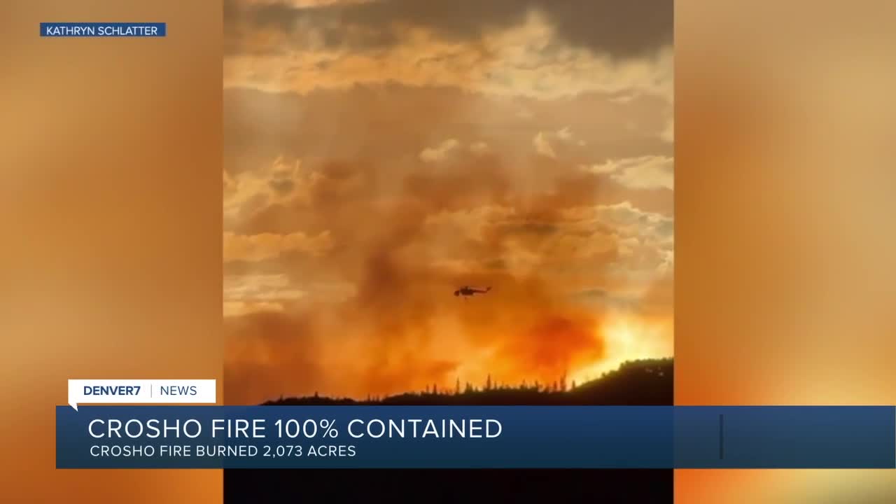
The 2,073-acre Crosho Fire, first reported on Aug. 11, burned in the Routt National Forest. The cause of the blaze, which threatened several structures, is unknown at this time.
No structures were lost in the fire. The following roads have reopened, according to Routt County officials:
- Routt County Road 132 from Routt County Road 15 to Dunckley Pass
- Routt County Road 25 from Routt County Road 132A to Routt County Road 132
- Routt County Road 19 from Routt County Road 15 to Routt County Road 25
- Rio Blanco County Road 8 (Dunckley Pass) at the intersection of Rio Blanco County Road 8 and Rio Blanco County Road 19
The only road that remains closed is Routt County Road 15 from the intersection of Routt County Road 17 to Crosho Lake.
Meanwhile, the Lee Fire, which is also burning in Rio Blanco County, became the fourth-largest blaze in Colorado history Monday, a little more than three weeks after igniting southwest of Meeker.
As of 9:30 p.m. Monday, the fire has burned 138,844 acres and is 90% contained.
Denver7 is tracking several other wildfires on Colorado's Western Slope. Below is a summary of those fires, containment amounts and where residents can learn more details.

Size: 5,345 acres
Containment: 0%
First reported: Aug. 16
Cause: ⚡️
Location: 13 miles north of Dotsero
Evacuations 🏠: Mandatory evacuations and pre-evacuation notices can be viewed here.
The lightning-sparked Derby Fire, first reported on Aug. 16, is burning 13 miles north of Dotsero in Eagle and Garfield counties.
In an update Monday, fire officials said three-quarters of recent growth on the fire's southeast flank has been halted thanks to new control lines. Air support dropped flame retardant and water on the area on Monday.
The fire is growing slowly on other parts of its south perimeter. Firefighters are constructing new control lines in order to slow that growth.
Officials said structure protection crews are working along Red Dirt Creek Road. Firefighters have positioned sprinkler kits and removed surrounding fuels in an attempt to protect more than 500 structures.
Updates posted to:
InciWeb
Derby Fire Colorado

Size: 138,844 acres
Containment: 90%
First reported: Aug. 2
Cause: ⚡️
Location: 18 miles southwest of Meeker
Evacuations 🏠: For the most up-to-date evacuation map, click here.
Pre-evacuations: For the most up-to-date pre-evacuation map, click here.
The lightning-sparked Lee Fire, first reported on Aug. 2, is burning 18 miles southwest of Meeker in Rio Blanco County. Three homes and 12 outbuildings have burned so far.
The FDNY Incident Management Team assumed control of the fire Monday morning. Crews worked Monday to continue securing its perimeter.
Officials said fire activity remained minimal on Sunday, with only "isolated creeping and smoldering observed."
A wet weather pattern is expected this week, with a 90-100% chance of daily rainfall in the area through Thursday. Fire officials said these storms may bring periods of heavy rain, frequent lightning, gusty winds and small hail.
The Rio Blanco County Sheriff's Office downgraded Evacuation Zones 20, 21, 22, 23, 61, 62, 63 and 64 from SET (yellow) to READY (green) on Monday. Evacuations for Zone 50 were lifted. To see what zone your address falls into, click this link.
A partial closure of the White River National Forest is still in effect due to the fire within the Blanco Ranger District west of and including the Long-Lost Trail system.
Updates posted to:
Elk and Lee Fire Information
Rio Blanco County Sheriff's Office
InciWeb

Size: 10,249 acres
Containment: 42%
First reported: July 28
Cause: ⚡️
Location: 5 miles west of Rico in the San Juan National Forest
Evacuations 🏠: No current evacuations
The lightning-sparked Stoner Mesa Fire, first reported on July 28, is burning west of Telluride inside the San Juan National Forest in Dolores County.
In an update Monday evening, fire officials said the San Juan Team 8 Incident Management Team will assume responsibilities for the fire on Tuesday. Firefighters on Monday were able to take advantage of the wet weather that moved through the area.
To sign up for Dolores County emergency alerts, click here. To sign up for Montezuma County emergency alerts, click here.
Updates posted to:
Stoner Mesa Fire Information
USDA Forest Service Facebook page
InciWeb

Blue Ridge Fire
Size: 25 acres
Containment: 100%
First reported: Aug. 15
Cause: Under investigation
Location: La Plata County
Notes: All evacuation and pre-evacuation orders lifted on Aug. 18.
Crosho Fire
Size: 2,073 acres
Containment: 100%
First reported: Aug. 11 at 3:25 pm.
Cause: Unknown
Deer Creek Fire
Size: 17,724 Acres
Containment: 100%
First reported: July 10
Cause: Under investigation (as of last update on Aug. 12)
Location: Eastern Utah and Montrose County (Colorado)
Leroux Fire
Size: 195 Acres
Containment: 100%
First reported: Aug. 3
Cause: ⚡️
Location: Delta County
Oak Fire
Size: 75 acres
Contained: 78% (as of last update on Aug. 13)
First reported: Aug. 10
Cause: Structure fire
Location: Archuleta County west of Pagosa Springs
Notes: The Archuleta County Sheriff's Office said two suspects have been arrested in connection with an illegal burn that started this fire. The suspects have been identified as Sergio Alaniz Jr., 41, and Ross Heirigs, 60. They were arrested on charges of fourth-degree arson.
Peninsula Fire
Size: 17 acres
Containment: 80% (as of last update on Aug. 10)
First reported: Aug. 8
Cause: ⚡️
Location: South of Highway 145, between Norwood and Placerville
South Rim Fire
Size: 4,232 Acres
Containment: 100% containment likely will not occur until snowfall
First reported: July 10
Cause: ⚡️
Location: Black Canyon of the Gunnison National Park
Turner Gulch Fire
Size: 31,699 acres
Contained: 96%
First reported: July 10
Cause: ⚡️
Location: 8 miles northeast of Gateway in Mesa County
Evacuations 🏠: All evacuation orders have been lifted
Wright Draw Fire
Size: 466 acres
Containment: 100%
First reported: July 10
Cause: ⚡️
Location: Mesa County
Windy Gap Fire
Size: 30 acres
Containment: 100%
First reported: Aug. 6
Cause: Unknown
Location: Grand County
Yellowjacket Fire
Size: 29 acres
Contained: 40% (as of last update on Aug. 16)
First reported: Aug. 15
Cause: Unknown
Location: Northeast of Meeker


Denver7 is committed to making a difference in our community by standing up for what's right, listening, lending a helping hand and following through on promises. See that work in action, in the videos above.