

How many times have you driven by Georgetown Lake going to the mountains or going home? Maybe you’ve seen people fishing at the lake in the summer, or ice fishing in tents in the winter. Maybe you’ve even seen Jeeps racing on the lake in the winter.
But did you know there is a hiking trail that circles the lake? The 1.4-mile loop is a crushed rock path close to the water.
While there are several parking lots, the best place to start is at the Georgetown bighorn sheep viewing area. You can take the stairs or the ramp to the top where there are three spotting scopes and lots of information about bighorn sheep.

If you don’t spot any sheep at the beginning of your hike, you can try again afterwards.
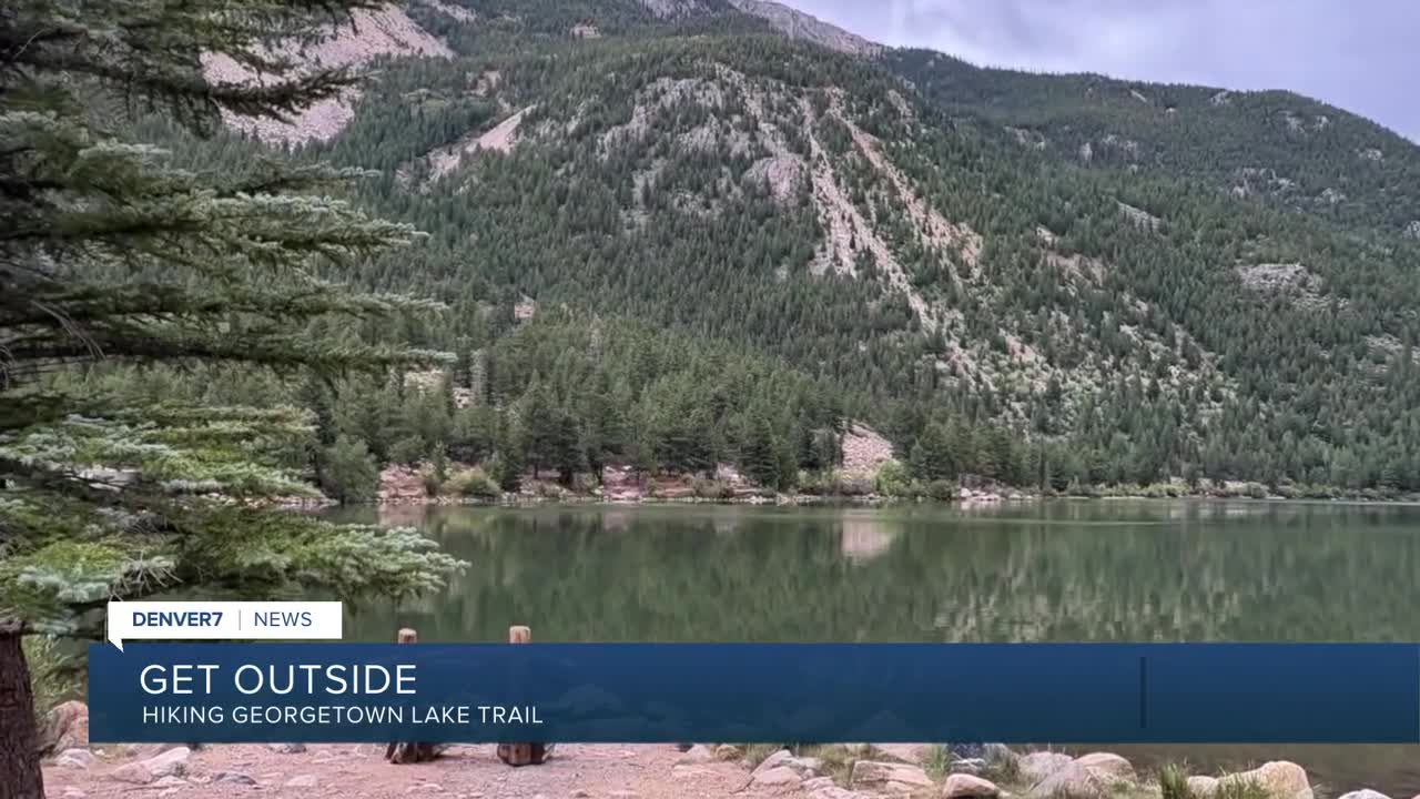
As you walk the path, you’ll see people fishing, the occasional bench to sit and enjoy the views, and hopefully, beautiful wildflowers. You may even spot some people boating on the water.
I decided to walk clockwise, toward the dam. The Harry M. Locke Dam is named for a state lawmaker who was largely responsible for it being built.
There’s also a bridge here where you can watch the water going over the spillway and down the creek’s path. This is Clear Creek, and in the summer there are several companies in the Idaho Springs area that offer rafting a little farther downstream.
On the mountain side of the reservoir, the path wanders through a forest of trees with at least two picnic tables next to the water.
About halfway around the lake, you’ll come to a sign and a turn off for the Dunbarton Trail, which connects to the Silver Creek Trail.
"A ridge/ledge hike on Saxon Mountain which you may have all to yourself,” Kevin Gravina wrote on MountainProject.com.
A nearby bench reminds you to see widely. Or go a few more steps to a platform on the water for fishing or just sitting and enjoying the view.

If you’ve walked this trail before, you may remember the fishing platform and bench was on the other side of the lake. It was moved this year, into a cove. Workers told me the wind was beating the platform up too much on the other side of the lake.
Because the trail is so close to I-70, you will have traffic noise the whole way around the loop, but it's still a pleasant walk. Even if you don't sit and enjoy the views on the benches, make sure you read the messages. Each one is different. Some I saw included "Be a gentle soul," "Never give up," and "Let go."
At nearly 9/10 of a mile around the lake, you’ll come to another trail split. The Purdy Trail also connects to the Silver Creek Trail.
Nearby, you’ll find a sign that talks about Tom Bennhoff, the man who rallied resources and funding to build the lake trail. It also talks about Tom Hale, the former town administrator who helped get the trail finished after Tom Bennhoff passed away.

As you get closer to the town side of the lake, you'll find two parking lots and even a brewery, if a hike has you thinking about a drink.
Back on the highway side of the lake, the path goes past multiple parking lots and even a few bathrooms, a warming hut and another fishing platform.
When you get back to your vehicle, consider another look through the spotting scopes on the viewing platform.
Details: The loop is about 1.5 miles with just minimal elevation gain. Parking is free.
Directions: From I-70, take the Georgetown exit. Turn left and drive to the roundabout. Go 3/4 of the way around and exit on Argentine Street. Drive about 1.2 miles, past a couple parking lots to the parking lot with the viewing platform & spotting scopes.
If you have any questions, or hike suggestions, email me at HikingDebbie@gmail.com and find more great hikes by following me on Facebook at Facebook.com/DenverHikingExaminer.


Denver7 is committed to making a difference in our community by standing up for what's right, listening, lending a helping hand and following through on promises. See that work in action, in the videos above.
