


DENVER — It was an active weather day Saturday as severe storms moved rapidly north across the plains. Sunday saw more of the same as severe weather targeted parts of eastern Colorado.
The National Weather Service confirmed that at least nine tornadoes touched down in eastern Colorado Saturday. There were no reports of damages or injuries.
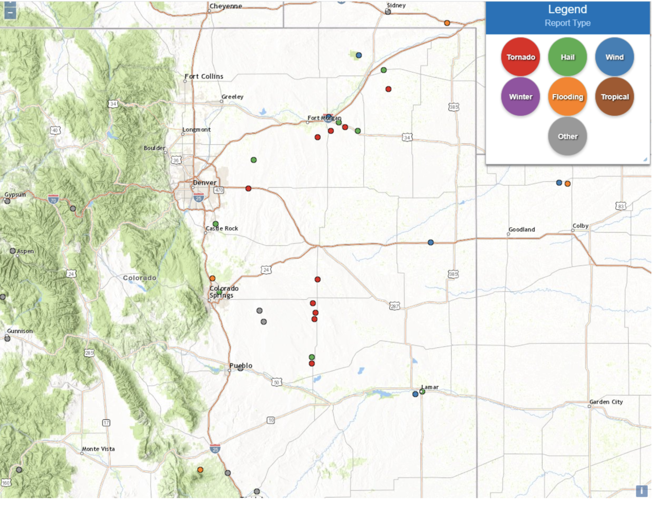
Here are the locations of Saturday's tornadoes, according to the NWS. All times are p.m.
- 1:30 | Tornado touched down 5 miles from Adena School
- 1:47 | Tornado touched down 6 miles southeast of Brush
- 2:03 | Tornado touched down 1 mile south of Midway
- 2:08 | Tornado touched down 2 miles south of Bennett
- 2:45 | Tornado touched down 6 miles southeast of Reiradon Hill
- 3:56 | Tornado touched down 1 mile northwest of Forder
- 4:00 | Tornado touched down 4 miles north of Forder
- 4:05 | Tornado touched down 4 miles north of Forder
- 4:30 | Tornado touched down 10 miles north of Punkin Center
More severe weather hit eastern Colorado Sunday. The NWS issued a tornado watch for parts of metro Denver, northeast Colorado, Kansas, Nebraska and Wyoming until 8 p.m. A few tornadoes are possible and scattered hail up to apple size are likely in the affected areas.
At least three tornadoes touched down in parts of the Eastern Plains Sunday. Several tornado warnings were issued for the area throughout the day.
Strong winds pounded the Denver area Sunday afternoon, knocking down a tree and onto a home at 1148 Josephine Street. Denver Fire said no injuries were reported and damage to the structure was limited.

The National Weather Service reported Sunday afternoon that severe storms will continue to race north and northeast across the plains at 40-50 mph. The highest threat of tornadoes, large hail, and damaging winds are with storms on eastern edge near Sterling, Akron and Limon.