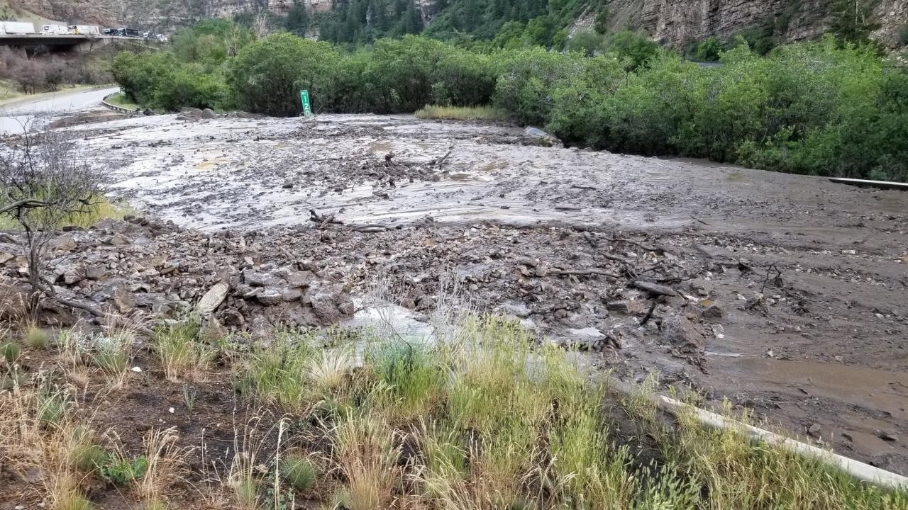
After a dry start to the week for much of the state, an increase in monsoonal moisture will bring a better chance for storms Thursday and Friday afternoon, and even more so through the weekend.
By Friday evening, a cold front will move into Colorado. Showers and thunderstorms are likely this weekend, and will bring some relatively cooler temperatures. Some locally heavy rainfall will be possible in the mountains and foothills.
While the rain will help the drought-riddled parts of the state, it also brings the returned threat of flash flooding, especially around burn scars.


The threat at the burn scars has been an ongoing issue over the past few weeks.
On July 20, a flash flood in Poudre Canyon killed at least two people and left two others missing as burned soil from the 2020 Cameron Peak Fire slid off hillsides.
Interstate 70 in Glenwood Springs has also closed several times in the past month due to mudslides crossing the highway.
On Wednesday, the Colorado Water Conservation Board reported that the risk of flooding at the Grizzly Creek Fire burn scar in Glenwood Canyon was high. There's also a moderate threat for the Pine Gulch Fire burn scar.
According to the National Weather Service out of Boulder, the threat of flash flooding around the burn scar of the East Troublesome, Cameron Peak, Calwood and Williams Fork Fires will increase from "none" and "limited" Tuesday and Wednesday to "elevated" for the weekend.
Burn area flash flood threat outlook: Only isolated to scattered showers/storms with light rain today and tomorrow over the mountains.
— NWS Boulder (@NWSBoulder) July 28, 2021
Then, threat for flash flooding ramps up by this weekend with more numerous storms containing heavy rain. #COwx pic.twitter.com/QtmRuP6lvi
The NWS also published the below six-hour loop showing how the rain will move through the state Wednesday through Sunday.
There will be a trend of moisture slowly increasing; resulting in more widespread showers and thunderstorms as the monsoonal moisture plume moves over region by this weekend. The loop shows 6 hour forecast precipitation totals (ending time shown) through Sunday evening. #cowx pic.twitter.com/tl0sr3O9Sl
— NWS Boulder (@NWSBoulder) July 27, 2021
The precipitation from these storms is part of the North American Monsoon (NAM), which is a "a shift in the wind pattern that allows for continuous moisture to flow from the Gulf of California into the normally arid southwest region of the country," according to the Colorado Climate Center. The NAM typically ramps up in July and lasts through August. While it's most common in the Four Corners region, it does spread farther into Colorado and Utah.
In 2020, Colorado's wildfires blew up after this timeframe, with the East Troublesome Fire and Cameron Peak Fire both growing immensely in October.
In April, the Colorado Division of Fire Prevention and Control warned that Colorado should expect another year of intense wildfires in 2021 due to ongoing drought conditions that could worsen through the summer.
Click here or below to watch the Denver7 live weather stream.


