


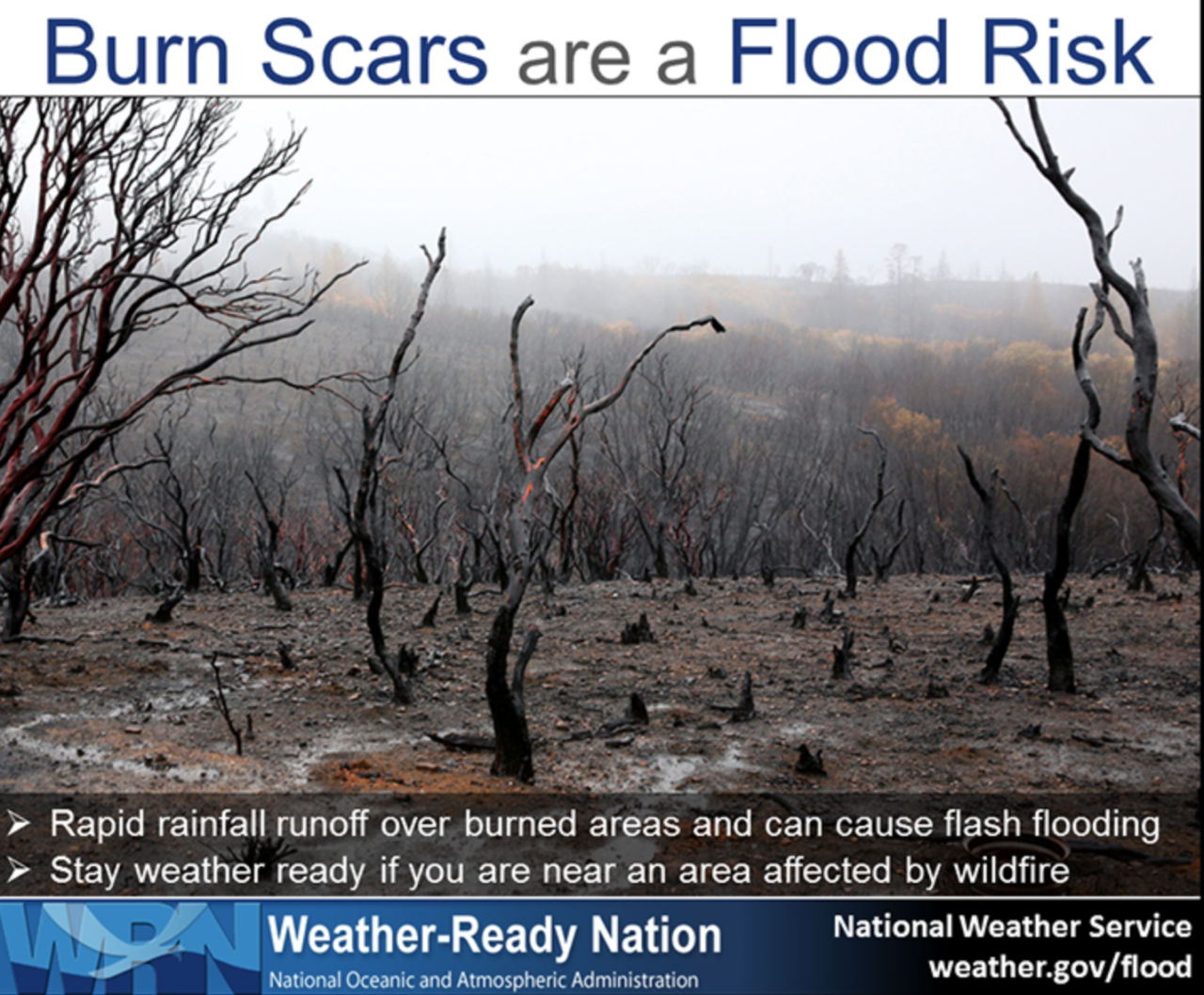
DENVER – Heavy rain over Colorado's burn scars caused flash flooding in parts of Boulder and Larimer counties Saturday, causing drinking water issues in Grand County. Multiple mudslide were also reported near Telluride in San Miguel County and on Loveland pass, where CDOT has shut U.S. 6 down.
The National Weather service issued a flash flood warning for the Calwood burn scar in Boulder County, but later upgraded it to "considerable threat" for flash flooding occurring in the area near Geer Canyon Dr. to Lefthand Canyon then to Hwy 36. The warning expired around 6:45 p.m.
Boulder County authorities issued a "climb to higher ground" order for areas of Geer Canyon and Lefthand Canyon, east of Geer Canyon, due to expected flooding and possible debris flows. Around 6 p.m., authorities gave the "all clear" after flood waters receded.
Flooding was also occurring in Larimer County. Authorities issued an alert to residents in The Retreat subdivision, warning them of dangerous flooding occurring in the area.
Thunderstorms were producing heavy rain across the the Cameron Peak burn area, where more than a half an inch of rain fell in 20 minutes. Authorities later downgraded the flooding threat in Larimer County and issued a voluntary evacuation order for areas near the Cameron Peak burn area.
On Friday, flash floods once again swept through Poudre Canyon in Larimer County. However, officials said Saturday there were no major structural damage to residences and there are no reported casualties or missing persons associated with Friday's flash flood event.
Debris and mud from the burn scars caused cloudy water in the Colorado River, prompting Grand County water officials to shut off an intake plant. County residents are being asked to conserve tap water for the next 48 hours as the county's public works department has stopped refilling a water storage tank.
Interstate 70 remains closed through Glenwood Canyon after more than 100 people were trapped Thursday night during heavy rains. The Colorado Department of Transportation said the closure there is expected to last through the weekend as crews clear heavy debris from mudslides.
CDOT crews worked aggressively to clear the debris and drain the water from the roadway on Saturday. While much progress has been made, CDOT said there remains the danger and risk of more slides with heavy rain in the forecast.
Loveland Pass is expected to be closed for much Sunday and probably longer due to a mudslide late Saturday near A-Basin. Traffic is being diverted onto I-70. CDOT said hazmat vehicles are being escorted through the tunnel at the top of the hour so regular traffic will be stopped to allow for this operation to take place.
On Saturday, multiple mudslides with debris, including boulders, swept across Colorado Highway 145 in the Sawpit area near Telluride in San Miguel County. The most severe slide occurred at mile marker 79 with 1-2 feet of debris and boulders that will require equipment to move. The highway is closed in both directions in that area and an extended closure is expected.
And Highway 14 through Larimer County – between Rustic and Larimer County Road 103 – was closed just after 2 p.m. because of flash flooding at the Cameron Peak burn scar.
Sunday's forecast calls for drier weather Sunday with a limited threat of flash flooding in the East Troublesome and Williams Fork burn areas.
Below are updates of the events as they happened across the state. You can keep up with the latest weather conditions and updates with the 24/7 weather stream on the Denver7+ app.
Saturday, July 31
4:51 p.m. | Larimer County flooding threat downgraded
Authorities downgraded the flooding threat in Larimer County. A voluntary evacuation order has been issued for areas near Streamside Dr, Corner Ct, Black Creek Dr, Copper Hill Rd, Saddle Ct, Fishermans Ln, Sheep Ln, and Miller Fork Rd from Copper Hill Rd to Bulwark Ridge Dr.
4:30 p.m. | "Considerable threat" issued for flash flooding in Boulder County
The National Weather service issued a flash flood warning for the Calwood burn scar in Boulder County, but later upgraded it to a "considerable threat" for flash flooding occurring in the area near Geer Canyon Dr. to Lefthand Canyon then to Hwy 36. The warning is in effect until 6:45 p.m.
3:44 p.m. | Flash flood warning in Boulder County
The National Weather Service issued a flash flood warning for for the Calwood burn scar in Boulder county until 645 pm. This includes the Little James Creek and Saint Vrain Creek areas within the burn scar.
3:24 p.m. | 'Widespread flash flood activity' in Larimer County
There is widespread flash flood activity throughout Larimer County, Larimer Emergency Telphone Authority tweeted. They are warning residents along creeks, streams or rivers in the Cameron Peak burn area to be aware of their surroundings and use extreme caution.
3:09 p.m. | Flooding occurring in The Retreat subdivision
Larimer County authorities issued an alert to residents in The Retreat subdivision, warning them of dangerous flooding occurring in the area. Thunderstorms are producing heavy rain across the the Cameron Peak burn area. More than a half an inch of rain fell in 20 minutes. The area is under a flash flood warning until 4:45 p.m.
3:04 p.m. | Multiple mudslides shut down CO 145 in San Miguel County
Officials said multiple mudslides with debris, including boulders, swept across Colorado Highway 145 in the Sawpit area near Telluride in San Miguel County. The most severe slide occurred at mile marker 79 with 1-2 feet of debris and boulders that will require equipment to move. The highway is closed in both directions in that area and an extended closure is expected.
2:48 p.m. | Flash flood warning in Larimer County
The National Weather Service issued a flash flood warning for the northwestern portion of the Cameron Peak burn area in central Larimer County until 4:15 p.m. Thunderstorms are producing heavy rain across the warned area. More than a half an inch of rain fell in 20 minutes.
A NEW Flash Flood Warning has been issued for the northern/northwestern portion of the Cameron Peak Burn Area. A precip gage measured 0.5" of rain in the past 20 minutes. This warning includes Rustic, Kinikinik, the Black Hollow area, and portions of CO-14. #cowx https://t.co/1tmKNxKnny pic.twitter.com/yImDEHkCCi
— NWS Boulder (@NWSBoulder) July 31, 2021
2:45 p.m. | No major structure damage from Friday's flooding
Larimer County officials said there were no major structural damage to residences and there are no reported casualties or missing persons associated with Friday's flash flood event near County Road 44H (Buckhorn Road) between County Road 27 and Pennock Pass. Officials said there is significant road damage and debris on County Road 44H and it will remain closed to traffic so that local residents can use it to evacuate if they choose.
9:55 p.m. | Burn scar flooding
The National Weather Service said burn scars will be particularly susceptible to flash flooding between 1 p.m. and 10 p.m. for Decker, Hayden Pass, Junkins and Spring burn scars. Repeated thunderstorm development could cause prolonged and serious flash flooding if this occurs on burn scars.
9:49 a.m. | Highway 133 reopens
Highway 133 in Pitkin County reopened Saturday morning following a mudslide Thursday that shut the highway down near the north entrance to Redstone.
9:46 a.m. | Potential for flash flooding continues
The potential for flash flooding continues through this evening. Flash flood watches are in effect in the northern, central, and southern mountains. The watch has been extended to include the Front Range from until 9 p.m. Saturday night.
Friday, July 30
10:45 p.m. | More flash flood warnings
The National Weather Service issued a flash flood warning for Lafayette, Erie and Firestone until 1:30 a.m.
10:44 p.m. | Small stream flood advisory in parts of Clear Creek, Gilpin counties
A small stream flood advisory is in effect along the border of northeast Clear Creek and southern Gilpin counties until 12:45 a.m., according to the National Weather Service.
9:58 p.m. | U.S. 550 reopens
The Colorado Department of Transportation reported the safety closure on U.S. 550 between County Road 31 and County Road 20W was lifted at approximately 9:55 p.m.
9:50 p.m. | County Road 2 closed for mudslides
Multiple mudslides have closed County Road 2 at Arrastra Gulch/Mayflower Mill, according to San Juan County Office of Emergency Management.
9:47 p.m. | Viestenz-Smith Mountain Park closed due to potential for flooding
Viestenz-Smith Mountain Park is closed until further notice due to the potential for flooding and hazardous conditions in the Big Thompson Canyon. Check updates here.
9:08 p.m. | Voluntary evacuations lifted in Larimer County
Voluntary evacuations have been lifted in Larimer County.
The voluntary evacuation on Highway 14 from mile marker 80 to mile marker 92 has lifted as well as along County Road 27 south of County Road 44H down to Bobcat Ridge.
The Larimer County Sheriff's Office said weather conditions have improved Friday night, but similar weather is expected Saturday. The office encouraged residents to stay informed of changing conditions to stay safe.
8:57 p.m. | Highway 14 reopened
Highway 14 has reopened in both directions from Highway 287, according to the Colorado State Patrol.
8:20 p.m. | U.S. 550 closed
The Colorado Department of Transportation said U.S. 550 is closed near Red Mountain Pass, between County Road 31 and County Road 20W, because of flooding and a mudslide.
7:34 p.m. | Flash flood warnings in Grand County expire
Flash flood warnings in place in Grand County impacting the East Troublesome and Williams Fork burn scars have expired, according to the National Weather Service.
7:27 p.m. | NWS issues more advisories for flooding
Eastern Douglas County and northwest Elbert are under a flood advisory until 8:45 p.m., according to the National Weather Service out of Boulder.
NWS also issued a flood warning for Buckhorn Creek in Larimer County until 10 p.m. due to very heavy rain over the Cameron Peak burn scar in that drainage.
7:22 p.m | Flash flood warning for Glen Haven, Masonville extended
The National Weather Service has extended a flash flood warning for Glen Haven and Masonville until 9 p.m. The original warning was set to expire at 8:45 p.m.
Flash Flood Warning continues for Glen Haven CO, Masonville CO until 9:00 PM MDT pic.twitter.com/R7xx0K4ojd
— NWS Boulder (@NWSBoulder) July 31, 2021
7:16 p.m. | Dangerous flooding on County Road 44H south down to Bobcat Ridge
The Larimer County Sheriff's Office issued an emergency message for dangerous flooding occurring on County Road 44H south down to Bobcat Ridge.
Anyone in the area should seek higher ground and avoid areas subject to flooding.
Drivers should not try to go through flood waters as the road might not be intact below the surface.
7:06 p.m. | Evacuation center opens in Larimer County
The American Red Cross of Northern Colorado opened an evacuation center for people affected by evacuations from severe flooding in the Cameron Peak Fire burn scar areas.
The evacuation center is at Foundations Church located at 1380 N. Denver Ave. in Loveland.
Red Cross volunteers are available to help anyone impacted with information or other assistance.
6:57 p.m. | Hanging Lake closed for the weekend
Hanging Lake is closed for the weekend due to flooding, mudslides and the closure on I-70, officials say.
Anyone who had reservations for the weekend will be refunded for their tickets and can try to make a new reservation, but tickets are sold out for the next two weeks.
The popular hiking spot is typically operating at 98-100% capacity every day because of online reservations.
6:49 p.m. | Highway 125 closed from Lazy U to Willowcreek Pass
Highway 125 is now closed between Lazy U and Forest Service Road 740 (Willowcreek Pass) due to a mudslide, according to the Grand County Sheriff's Office. There is no estimated time for when it may reopen.
6:18 p.m. | Flood advisories issued
The National Weather Service has issued several flood advisories in the metro area and mountains.
An urban and small stream flood advisory was issued until 7:30 p.m. for west central Adams County and southwestern Denver as heavy rain falls.
An urban and small stream flood advisory is in effect until 7 p.m. for east central Boulder County, northeastern Broomfield County and southwestern Weld County because of heavy rain and after more than an inch has already fallen.
Similar advisories are in effect for Eagle County until 7:15 p.m. and for Rio Blanco County until 7 p.m.
5:47 p.m. | Flash flood emergency in Larimer County
The National Weather Service has issued a flash flood emergency for southern Larimer County, where there are debris flows on the Miller Fork and North Fork of the Big Thompson drainages. The flash flooding is affecting The Retreat, Glen Haven and Drake.
Another voluntary evacuation has been issued for the area south of County Road 44H along County Road 27 south to Bobcat Ridge, west to Crystal Mountain Road.
A FLASH FLOOD EMERGENCY has been issued for southern Larimer County. Dangerous flash flooding and debris flows on the Miller Fork and North Fork of the Big Thompson drainages. The Retreat, Glen Haven, and Drake are all at risk of Flash Flooding. #COwx #CameronPeakFire pic.twitter.com/8jSVmz6i9n
— NWS Boulder (@NWSBoulder) July 30, 2021
5:33 p.m. | Flooding in Larimer County
The National Weather Service says roads are starting to wash out in the Cameron Peak burn scar area.
The Larimer County Sheriff’s Office said “dangerous” flooding was occurring on County Road 44H east of Pennock Pass, and said the road was washed out 6 miles west of County Road 27.
Dangerous flooding is also occurring in the Retreat subdivision in Glen Haven. “Immediately reach higher ground by any means necessary,” the sheriff’s office said. Click here for the latest emergency alerts from the sheriff's office.
5:03 p.m. | NWS issues, extends flash flood warnings
New flash flood warnings have been issued, and some of the warnings issued earlier today have been extended into the evening.
The flash flood warning for southwestern Park County remains in effect until 7:30 p.m. near the Weston Pass burn scar, where more than an inch of rain has already fallen and up to another inch could fall in the next two hours.
The warning for west-central Larimer County, including Chambers Lake and the Cameron Peak burn scar, has been extended until 6:15 p.m., where up to 3 inches of rain are possible.
The warning for the East Troublesome Burn scar, where multiple mudslides have been reported on Highway 125, remains in effect until 6 p.m.
In southern Larimer County, the flash flood warning remains in effect until 6:30 p.m. By 5 p.m., more than an inch of rain had already fallen and 1.5 to 2.5 inches of rain were expected in the area.
The warning for central Larimer County remains in effect until 6:15 p.m., including gulches along Highway 14 above Rustic, the Poudre River valley, Pingree Hill, Crown Point Road and more. Up to 3 inches of rain is possible.
A flash flood warning remains in effect until 7:15 p.m. for north-central Grand County.
3:50 p.m. | Severe thunderstorm warning in northern Colorado
The National Weather Service issued a severe thunderstorm warning until 4:15 p.m. for the areas including Wellington, Pierce and Nunn in northern Colorado. The NWS said travel is not recommended on I-25 because of hail and “torrential rainfall.”
3 p.m. | Flash flood warning in Grand County
A new flash flood warning has been issued until 6 p.m. for the East Troublesome Fire burn scar, including Highway 125 and the Drowsy Water Creek area.
Flash Flood Warning in effect until 6 pm for the #EastTroublesomeFire burn area. Highway 125 and Drowsy Water Creek are in the warning area. #cowx pic.twitter.com/P7NB8Ab5DW
— NWS Boulder (@NWSBoulder) July 30, 2021
2:56 p.m. | Williams Fork flash flood warning
The National Weather Service has issued a flash flood warning for the Williams Fork Fire burn scar area until 5:30 p.m. Friday.
Flash Flood Warning in effect for the southern end of the #WilliamsForkFire burn area, until 5:30 pm MDT. #cowx pic.twitter.com/yhSH0JKO8I
— NWS Boulder (@NWSBoulder) July 30, 2021
2:40 p.m. | Voluntary evacuations along Highway 14
As the National Weather Service extends a flash flood warning for the Cameron Peak burn scar area until 5:15 p.m. Friday, the Larimer County Sheriff’s Office issued voluntary evacuation notices for people living along Highway 14 between Shady Rest Lane and Indian Meadows.
The highway was shut down at Larimer County Road 103 to Rustic because of the flash flood warning. The highway is open to local traffic only from Ted’s Place to Rustic.
2:31 p.m. | CDOT confirms more than 100 people trapped early Friday in Glenwood Canyon
The Colorado Department of Transportation says the closure on I-70 through Glenwood Canyon “is anticipated to last through the weekend” and confirmed that 108 people were either evacuated from Glenwood Canyon or had been moved.
CDOT is planning on providing an update on I-70 at 3 p.m.
Noon | Flash flood watches in effect
By 6 p.m. Friday, flash flood watches will go into effect for most of the state, including the metro area. Watches are already in effect for most of Colorado’s mountains, and some flash flood warnings have been issued in Larimer County. Click here for more on the flash flood forecast.
Click here for the latest weather conditions and forecasts from the Denver7 team. Click here for the latest road conditions across the state. You can also get the latest weather updates on the 24/7 weather stream on the Denver7+ app.