

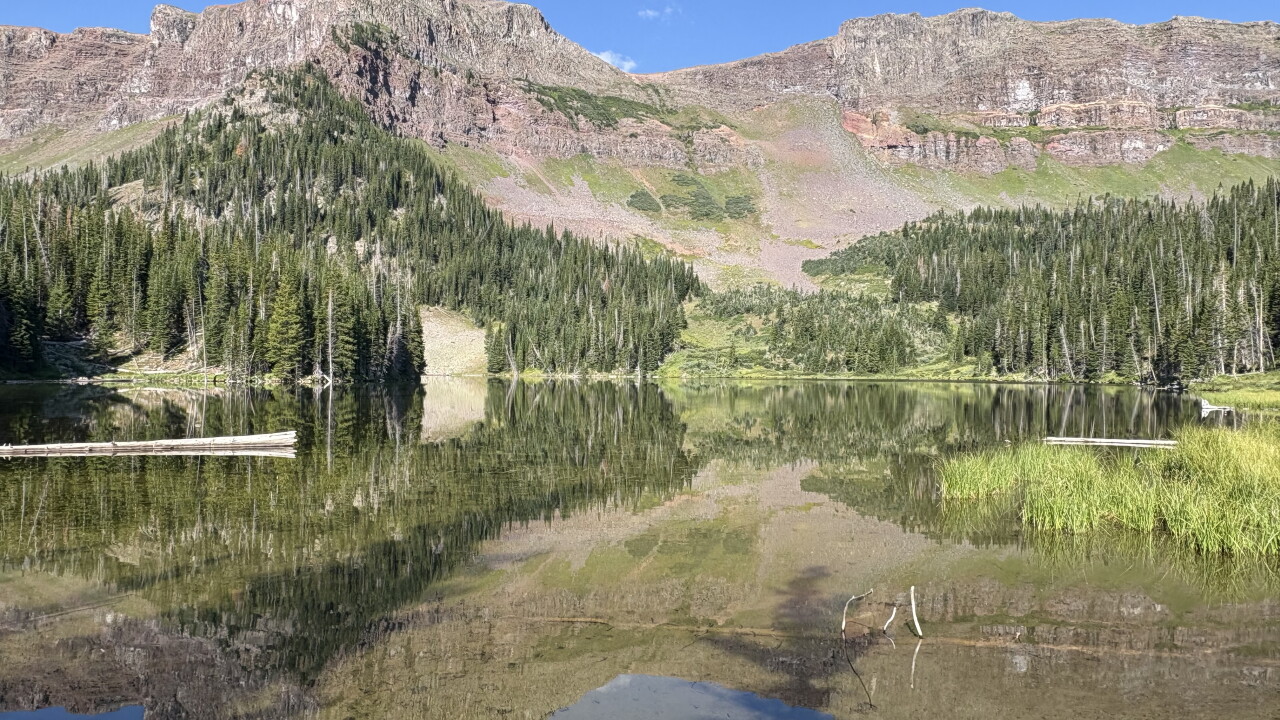

The Flat Tops Wilderness may be a bit of a drive from the Denver metro area, but hiking here means uncrowded trails, uniquely shaped mountains and lots of lakes.
While many hikers backpack here, we decided to stick to day hikes. The Mandall Lakes is a great area to get some mileage while enjoying multiple lakes, meadows, wildflowers, aspen groves and views of the Flat Top mountains.
The hike starts at a small parking area between Yamcolo Reservoir and Bear Lake Reservoir, just past a small sign that says Trail 1121 Mandall Creek.
Cross the road and look for the faint trail. Just a few steps into the trees, you’ll come to signboards and a trail register. Sign in because it tells the U.S. Forest Service how many people are using these trails. There is also a sign that talks about what to do if you encounter sheep or sheep dogs.
When we hiked here, the hooves of the sheep and horses had made the first part of the trail a bit rough. It’s about 0.75 miles from the parking lot to the wilderness sign. You’ll gain nearly 300 feet in that first section.
As you hike, you’ll quickly notice a pattern. The trail goes in and out of aspen groves with beautiful meadows in between. This would be a great place to hike when the leaves turn in the fall. It’s also a great place to hike mid-summer for wildflowers in the meadows.
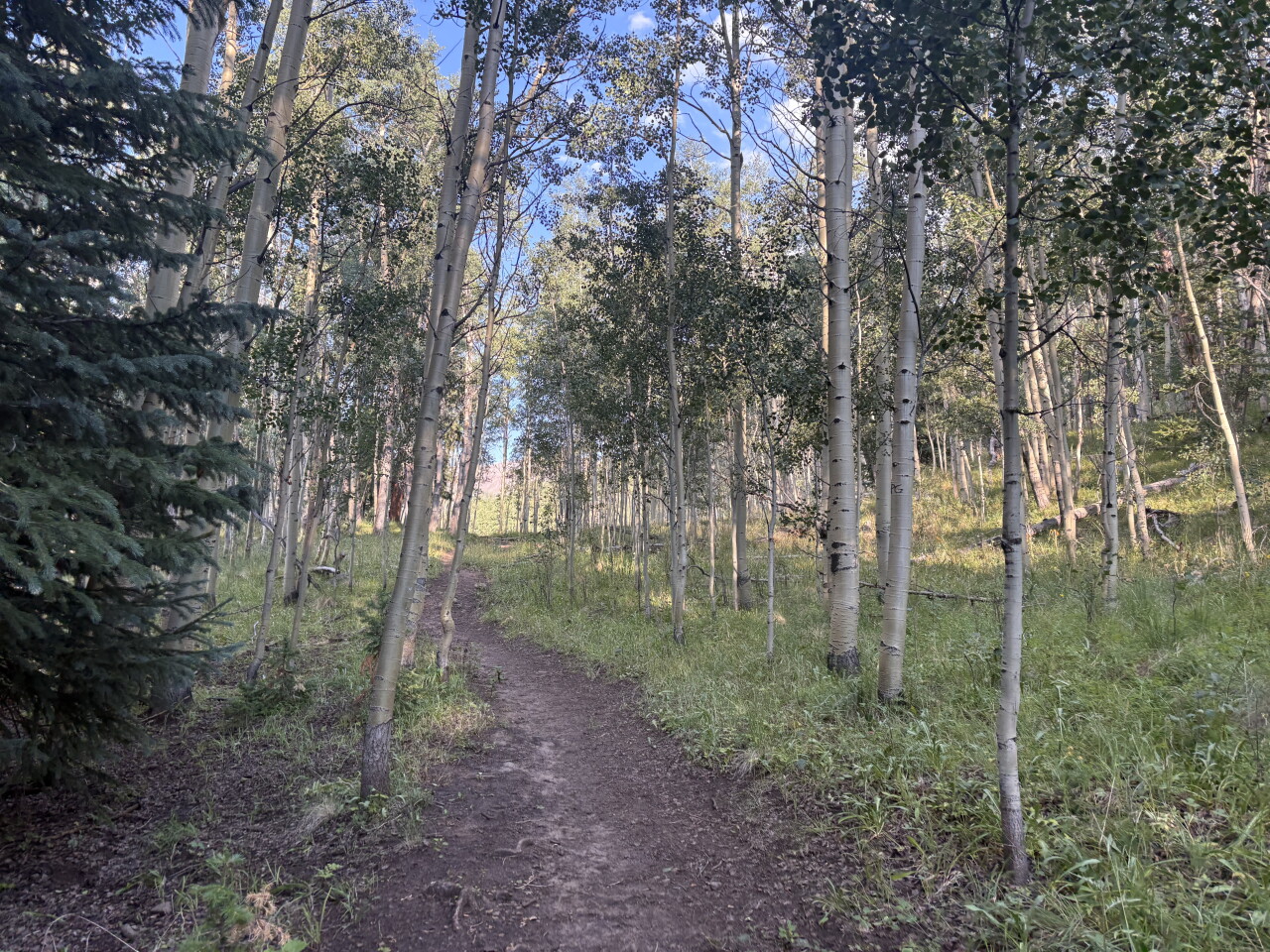
About 1.5 miles into the hike, the trail does something unexpected. It suddenly drops 250 feet in elevation from the forest to a very large meadow.
Over the next mile or so, you’ll be mainly crossing meadows. You’ll have a little uphill, then mostly flat walking, before repeating the process several times.
There are also a couple of water crossings, depending on when you visit. Most have logs or a combination of logs and rocks to help you keep your feet mostly dry.
At 3.5 miles, you’ll hike uphill by a nice cascade. At the top of the cascade is a patch of willows. This is when you’ll need your map on the AllTrails app or COTREX app because Slide Lake is nearby, but there is no sign on the main trail and the side trail to the lake is very faint.
You don’t want to miss Slide Mandall Lake because it’s beautiful. It sits in a rocky cirque below one of the Flat Top mountains. When we were there, the water was calm, creating a beautiful reflection.
You can turn around here for a hike of about 7.5 miles, but we continued on.
Next, you’ll hike uphill in the forest before coming to a meadow with a hill. As you climb the hill, you’ll have views of the Flat Top mountains for 270 degrees around you.
Follow the trail back into the trees to a trail split. Here the Mandall Lakes Trail turns left and continues up to Mandall Pass. We turned right for Black Mandall Lake just 0.15 miles away.
Black Mandall Lake has a nice hillside where you can pick a sunny spot or a shady spot for lunch. Or take pictures and return to Slide Mandall Lake, if you prefer that scenery.
While you eat lunch, or a snack, look at your map app. You may notice several other nearby names including Twin Mandall Lakes and Mud Mandall Lake. There’s no trail to the lakes, but friends tell me the other lakes are doable, if you have experience off trail.
Remember to save some energy for the hike back because there is a 250 foot, or so, climb on the way out.
Details: The hike to Slide Mandall Lake & Black Mandall Lake is about 9.4 miles roundtrip with about 1,550 elevation gain.
Remember that our beautiful places are getting overrun and need to be treated with kindness. Don’t pick the flowers, don’t leave dog poop bags to be picked up later, bring a wag bag for you just in case, don't play music out loud, check the weather, bring the 10 essentials and tell someone where you’re going and when you’ll be back.
If you have any questions, or hike suggestions, email me at HikingDebbie@gmail.com and find more great hikes by following me on Facebook at Facebook.com/DenverHikingExaminer.