



When you think of hiking in Colorado, you likely think of mountains or the foothills, but southeastern Colorado has trails full of history like Picketwire Canyon, Crack Cave, the Santa Fe Trail and Vogel Canyon.
Vogel Canyon has homesteading ruins and petroglyphs.
The Vogel Canyon Trail starts at the Vogel Canyon Picnic Area, about 17 miles south of La Junta. The trailhead has picnic tables, a bathroom and signs about the trails in the area. We decided to do a loop of the Canyon, Prairie and Overlook trails to see as much as possible.

The Canyon Trail starts on a single-person wide path near the middle of the picnic area between the signs and the bathroom. I highly recommend downloading the trail map from COTREX and AllTrails before you go, because it does get a little confusing and each app has different highlights marked. You'll know you're on the right path when you pass through a squeeze gate with a sign that says, "Canyon Loop Trail 1.75 miles."
From here, the trail gets a little faint at times, but there are very large rock cairns along the path. How large? We're talking wire cages that are one to three feet tall with large rocks inside.
Just one third of a mile from the trailhead, there's a split. AllTrails shows this as trail number 1892.A. Having the map open will help you find it. The trail to the right takes you to a cabin ruin. A sign explains, "In 1937, the government launched a program to restore lands ravaged by the Dust Bowl. Under the Bankhead-Jones Farm Tenant Act, the government bought back failed and marginal farmlands at an average of $4.40 an acre and began restoration activities."
One of those bought back was the Westbrook Homestead. You can still see their fireplace and other stone walls.
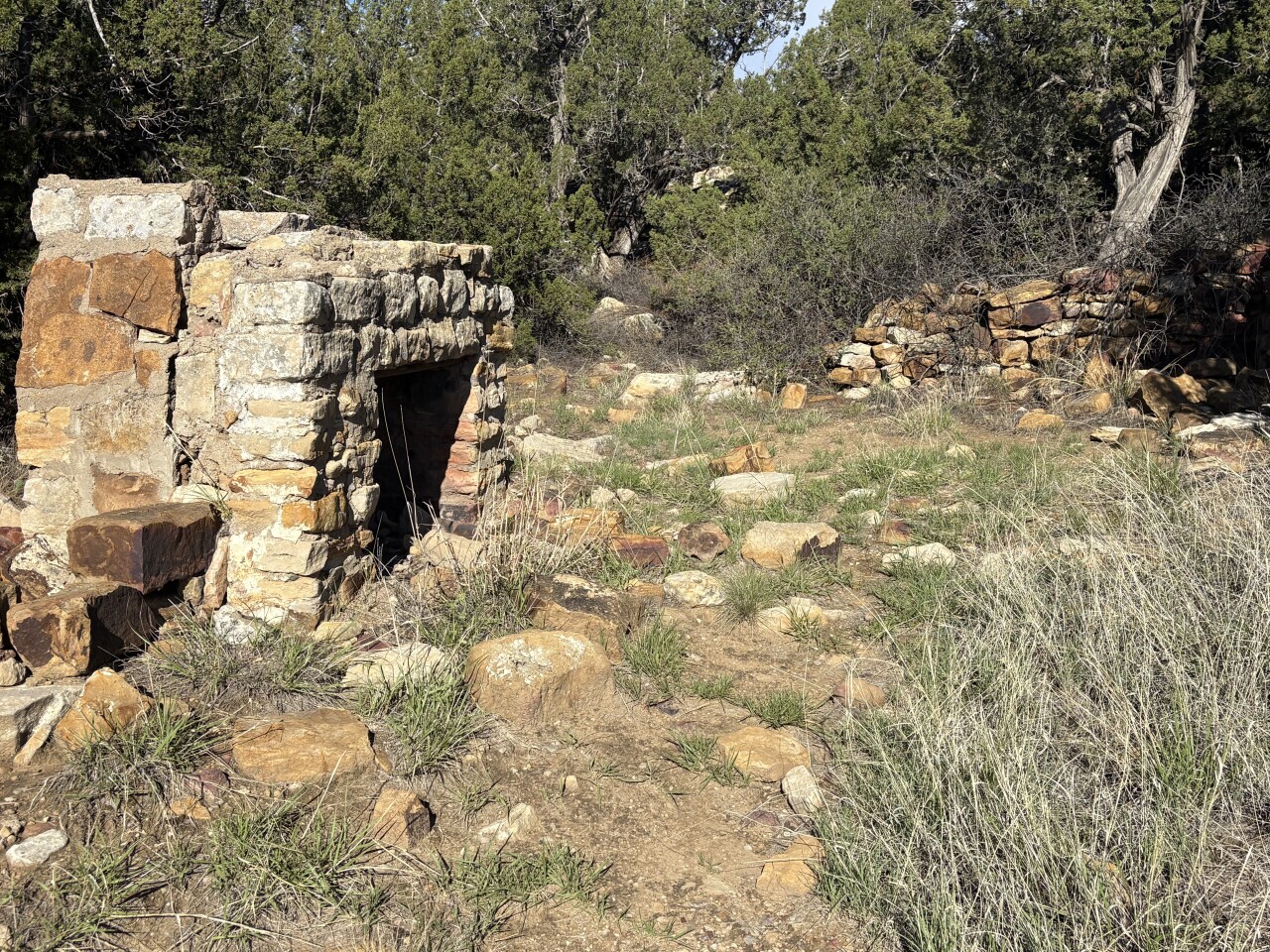
The AllTrails app has a second mark in this area showing another cabin ruin. It's not far away, but the map will help you find the cabin ruin and get back to the main trail.
About 0.75 miles from the trailhead, you may notice a trail on the left and a few steps away, a sign. This trail is called the Rock Art 2 Spur on COTREX. Look closely at the rock walls. It's easy to see historic glyphs left by settlers in 1927. You'll have to look closer to see petroglyphs pecked into the rock by Native Americans.
A sign explains hunters came here 1,500 years ago looking for deer and rabbits and gathered wild plants for food and medicine.
The Spur Trail got faint, so we went back to the main trail. When you come to the spot where the Spur Trail ends, you can follow it back again to the rock wall. A sign here depicts the petroglyphs on the wall, making it easier to spot some of them, especially collections of lines and what may have been shields. The sign says there are 49 petroglyphs in this spot.

From here, it's decision time. You can return to the picnic area for a hike of about two miles roundtrip. Or you can turn on the Prairie Trail to create a loop.
The Prairie Trail is still on the bottom of the canyon. The trail gets faint occasionally, but there are (once again) piles of rocks in wire cages, but in this area, the piles are shorter with brown, wooden signs and arrows to help you stay on track.
The trailhead sign says this path is the old Barlow and Sanderson Stage Road, a spur of the old Santa Fe Trail used in the 1870s to deliver mail between Las Animas and Trinidad. While we didn't see any wagon ruts, we did see another cabin ruin.
After a mile on the Prairie Trail, we turned at the sign for the Mesa Loop Trail. Like its name, the trail climbs about 60 feet in elevation, back on the mesa.
When the trail ends at the Overlook Trail, you can turn left for the parking lot or add just a little more distance by turning right and walking a quarter mile to the overlook. It's a nice view of the canyon you hiked earlier. There's also a sign showing the route of the Santa Fe Trail's Mountain Route, the Cimarron Route and the Barlow & Sanderson Stage Road.
When you're done enjoying the view, take Overlook Trail back to the parking lot.
Details: The hike to the first cabin ruins and petroglyphs and back is about two miles roundtrip. The loop is about three miles roundtrip with 150 feet of elevation gain. You can create a longer loop by staying on the Prairie Trail to the road and hiking back to the parking lot.
For directions, Google Vogel Canyon Picnic Area.
If you have any questions, or hike suggestions, email me at HikingDebbie@gmail.com and find more great hikes by following me on Facebook at Facebook.com/DenverHikingExaminer.