
When the snow falls in Colorado, some of the most beautiful places to hike are places with red sandstone rock formations like Roxborough Park, Red Rocks Ampitheater's Trading Post Loop and South Valley Park.
While snow has yet to really hit the Front Range, you can mark this hike down as a good choice for wintry weather.
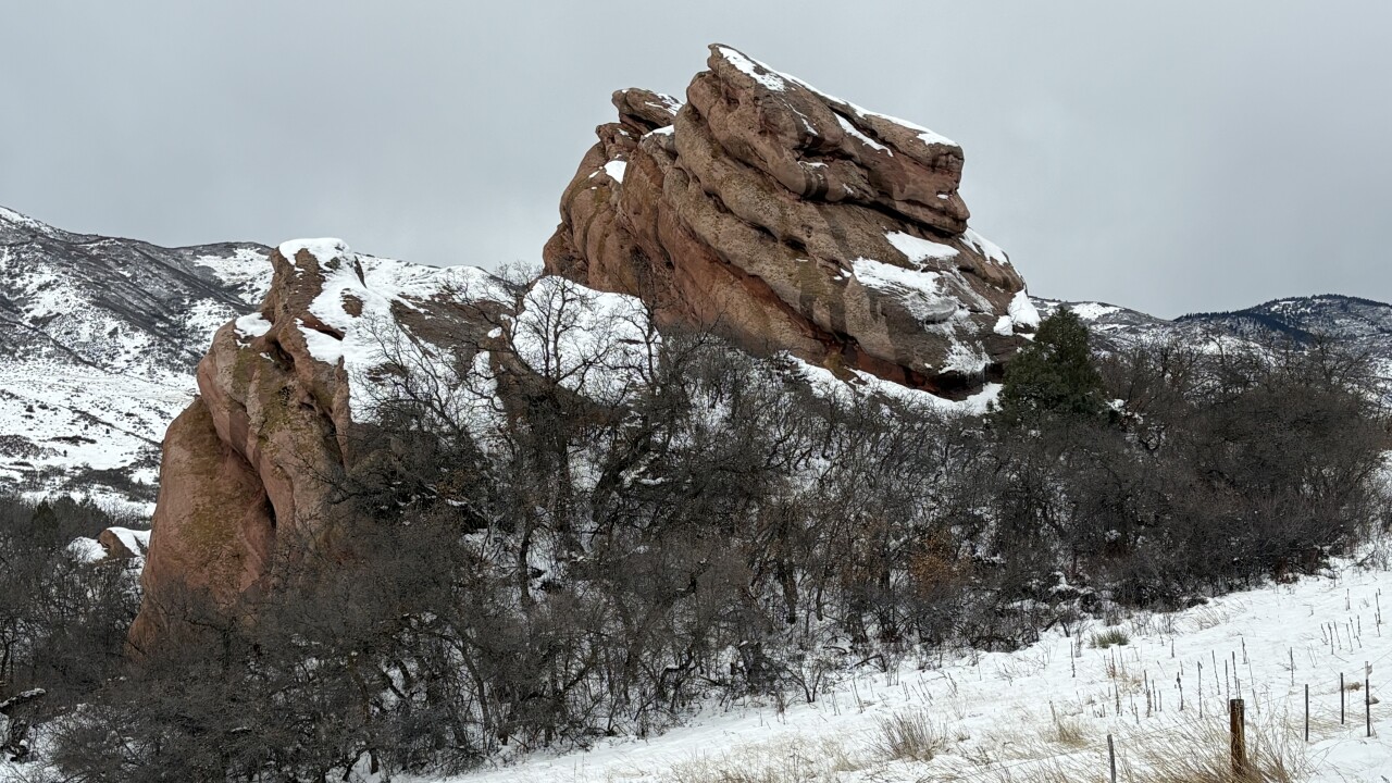
Jefferson County Parks & Open Space describes South Valley Park as having "dramatic red sandstone spires and stunning views of craggy outcroppings." While you can't climb the rocks, there are hiking trails that take you around the formations.
There are two trailheads: A north trailhead on S. Valley Road and a south trailhead on Deer Creek Canyon Road. We started at the north trailhead, which has bathrooms, picnic tables, a sign board and maps.

The main park loop is only about two miles, so I highly recommend getting a map if you want a longer hike. There are options to hike into the South Hogback Open Space, Deer Creek Park, South Valley Park trails on the other side of South Valley Road, and along South Valley Road.
My goal was a hike of about five miles, with no road crossings, so we decided to do the main park loop and the loop in the South Hogback Open Space.
We started on the Coyote Song Trail. You hike a short distance uphill, turn south and get a great view of the park and area. From here, it's about a half mile slightly downhill to the turnoff for the Lyons Back Trail.
The Lions Back Trail is a short trail that takes you up and over the hogback (a ridge with that resembles a hog's back). At the top, you'll see a valley to the east — that's where we'll be hiking.

For now, head downhill to the Columbine Trail. You can go either way on this loop. We chose left, or clockwise.
The Columbine Trail heads down into the valley passing through some oak trees and open meadows.
At the bottom, turn right on the Cathy Johnson Trail. You're now in the middle of the South Hogback Open Space valley and heading slightly downhill. A sign along the trail has a map showing most of the area around the Cathy Johnson Trail closed to protect sensitive plant and animal habitat and cultural artifacts. The sign also explains that the Ken Caryl Ranch Metropolitan District is working on a plan to protect these resources. For now, that means staying on the trail.
After nearly a mile on the Cathy Johnson Trail, you'll see a turnoff on the right with a small sign for the Columbine Trail. Turn here to finish the loop and go back to South Valley Park. Because we came downhill to the Cathy Johnson Trail, you'll hike up the side of a hill to get back to the hogback.
At the top of the hogback, you'll once again get nice views of South Valley Park, the nearby foothills and the surrounding area. On the way down, you may see a break in the fence and a short walk to an overlook.
At the bottom of the trail, you'll return to the Coyote Song Trail. You can turn right and head back to the parking lot, or turn left and finish the loop. We decided to continue on the loop and see more of the red rock formations.

It's less than a half mile to the Prairie Falcon Trail. This is part of the main loop, so we turned here. However, take a look at your map here. You can continue hiking south to the south parking lot, or take Prairie Falcon across the road to the west section of South Valley Park. We decided to take Prairie Falcon to the next turnoff and take the Swallow Trail back to the parking lot.
The Swallow Trail takes you on the other side of the red rock formations you saw on the Coyote Song Trail. Look closely as you hike by and you may even see an arch up high. You may also see lots of small swallow nests lined up on the rock, likely how the trail got its name.
If you notice some buildings to the west, that's Lockheed Martin.
There's even a small lake along the Swallow Trail. There's no trail to the lake, or around it, because it is actually a private reservoir. From there, it's just a short distance back to the parking lot.
DETAILS: The hike on the main park loop (Coyote Song/Swallow Trail) and the loop in the South Hogback Open Space (Columbine/Cathy Johnson Trail loop) was 4.75 miles with 600 feet of elevation gain.
Download the free COTREX map app or the paid AllTrails map to help you navigate.
If you have any questions, or hike suggestions, email me at HikingDebbie@gmail.com and find more great hikes by following me on Facebook at Facebook.com/DenverHikingExaminer.